Aller au contenu principal
Weather
Map
GB
Voir les favoris
en
New Caledonia Tourism: The official website for tourism in New Caledonia
Discover the archipelago
Aerial view of Nouméa, New Caledonia
©
Aerial view of Nouméa, New Caledonia
Nouméa
Top experiences in Nouméa
Amédée Lighthouse
Tjibaou Cultural Centre
Nouméa's bays
Aquarium des Lagons
All things to do and see in Nouméa
Kiki Beach, Lifou
©
Kiki Beach, Lifou
The Islands
Top island experiences
Isle of Pines
Ouvéa
Lifou
Maré
All things to do and see in The Islands
Cattle return to the Néméara farm, Bourail
©
Cattle return to the Néméara farm, Bourail
West coast
Top West Coast experiences
Bourail
La Foa - Farino
Koné - Voh - Pouembout
Poum - Koumac
All things to do and see on the West Coast
Linderalic rocks, Hienghène
©
Linderalic rocks, Hienghène
East Coast
Top East Coast experiences
Hienghène
Poindimié
Thio
Hienghene’s hen and rock formations
All things to do and see on the East Coast
Bivouac at the Blue River Park, Yaté
©
Bivouac at the Blue River Park, Yaté
Great South
Top Great South Experiences
Yaté
Mont-Dore
Blue River Provincial Park
Casy islet
All things to do and see in the Great South
Must-see places
Geography & biodiversity
History of the archipelago
11 reasons to come
Activities
Snorkeling with a lagoon turtle
©
Snorkeling with a lagoon turtle
Heavenly lagoon
Beaches and islets
Diving
Snorkelling
Whale watching
Sailing and navigation
Preserved natural spaces
Birdwatching at the Parc des Grandes Fougères
©
Birdwatching at the Parc des Grandes Fougères
Preserved nature
Hiking, walking, trail running
Boardsports
Horse Riding
Mountain biking and cycling
Scenic flights
Kayaking
Traditional Kanak dancers
©
Traditional Kanak dancers
Authentic cultures
Kanak culture
Bush culture
Local Art
Museums
Heritage
Not-to-be-missed events
Lobster on the beach facing the lagoon, New Caledonia
©
Lobster on the beach facing the lagoon, New Caledonia
Local gastronomy
Local produce
Local cuisine
6 dishes to try in New Caledonia
Where to eat Bougna?
Relaxing in front of the lagoon on the Isle of Pines
©
Relaxing in front of the lagoon on the Isle of Pines
Leisure and relaxation
Nightlife
Spa and wellness
Golf
Romance
Top relaxing experiences
Cruise
Family
Inspiration
Top 50 experiences
Plan your trip
Accommodation
Hotels
Gîtes
Tribal Stays
Youth hostels
Campsites
Eco-responsible
Serviced apartments
All accommodations
Bar of the Sheraton Deva hotel in Bourail
©
Bar of the Sheraton Deva hotel in Bourail
Bars and restaurants
Road trip to Hienghène, seaside road
©
Road trip to Hienghène, seaside road
Transport
Fête Nationale in Nouméa
©
Fête Nationale in Nouméa
Calendar of Events
Beach of the hotel Paradis d'Ouvéa
©
Beach of the hotel Paradis d'Ouvéa
Special offers
Travel guide
Plan your trip from A to Z
Travel specialist
Passport, visa and customs
Flights to New Caledonia
Airport information
Mobile Internet
Arriving by boat
Money and currency
Health & Safety
Weather and seasons
Traditions
Brochures
F.A.Q
Getting around
Itineraries / Road trip
Homepage
Three Bays Trail
Three Bays Trail
Sport
Pedestrian sports
Hiking itinerary
Route de Poé, 98870 Bourail
Getting there
×
Open the itinerary in
Google Maps
Apple Plans
Waze
Mappy
Share
Ajouter aux favoris
Add to my favorites
×
Share this sheet
Three Bays Trail
E-mail
WhatsApp
Facebook
X
LinkedIn
Pinterest
©
@J.F. Clair
©
@J.F. Clair
©
© Martial Dosdane
©
© Association Bwara
×
©
@J.F. Clair
©
@J.F. Clair
©
© Martial Dosdane
©
© Association Bwara
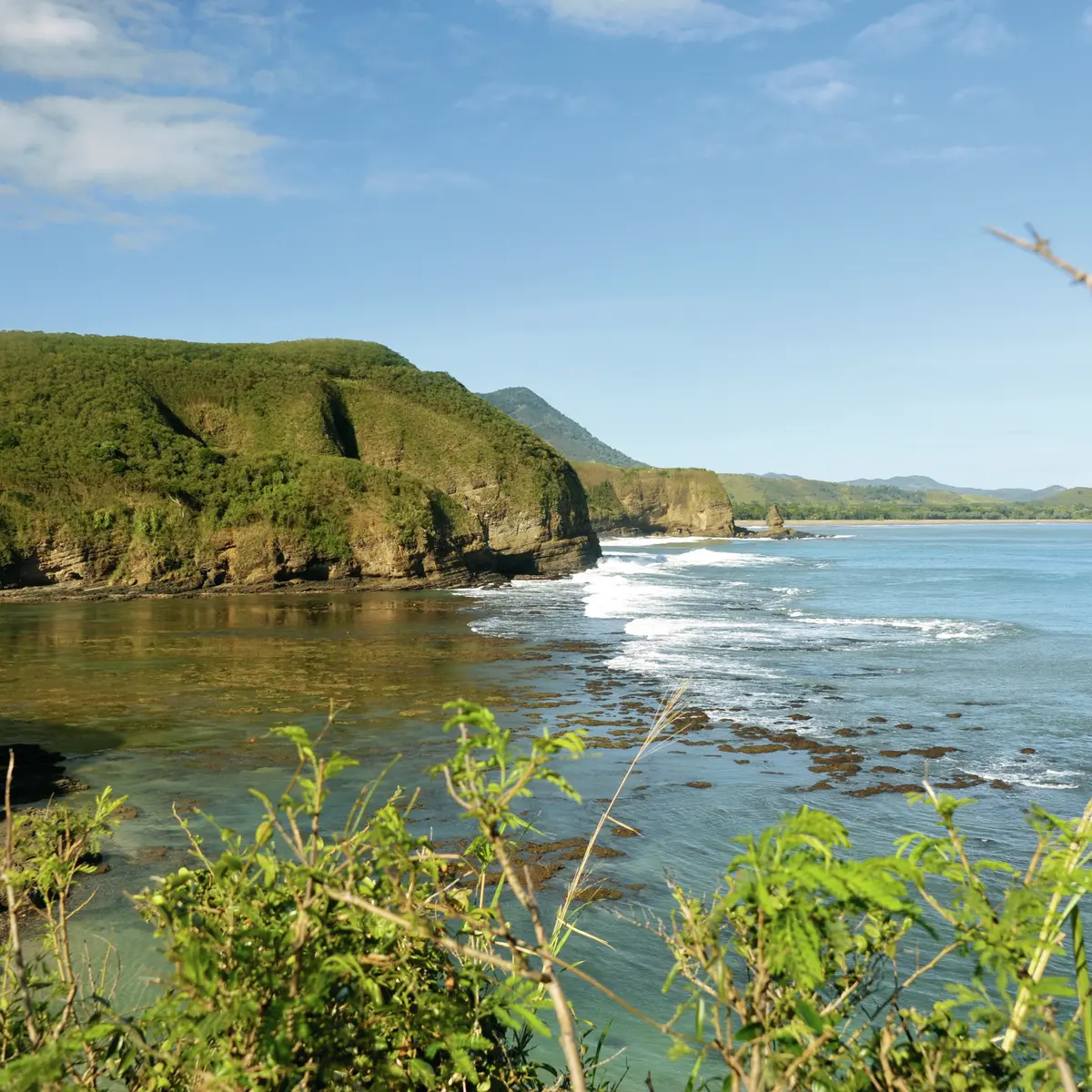
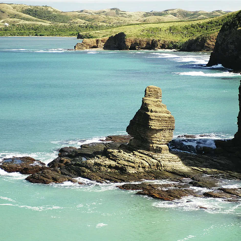
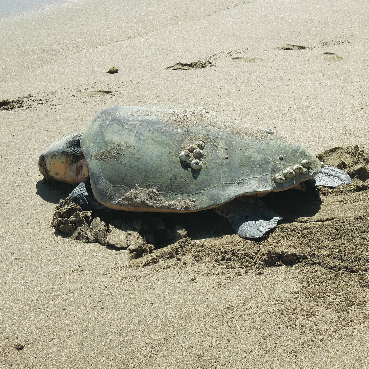
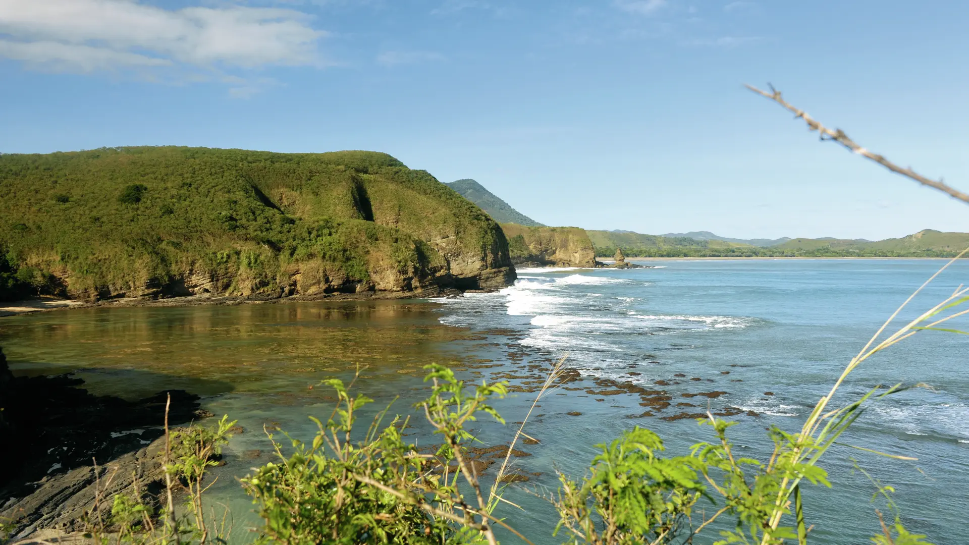
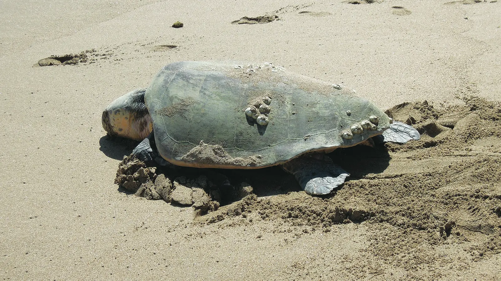
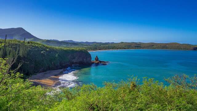
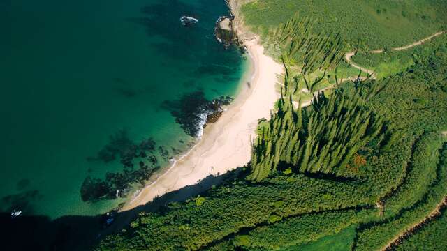
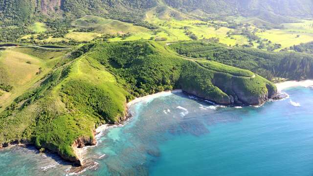
This trail winds between sea and cliffs from its starting point at La Roche Percée through Turtle Bay where the loggerhead sea turtles (Caretta caretta) lay their eggs in large numbers and on to Lovers’ Bay.
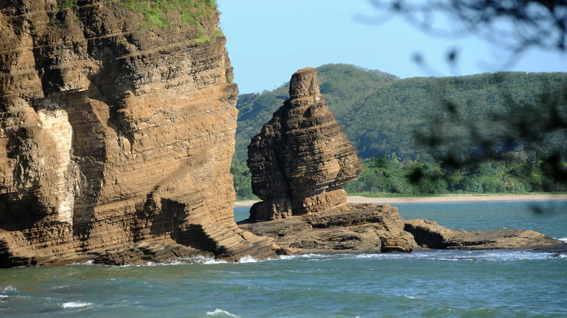
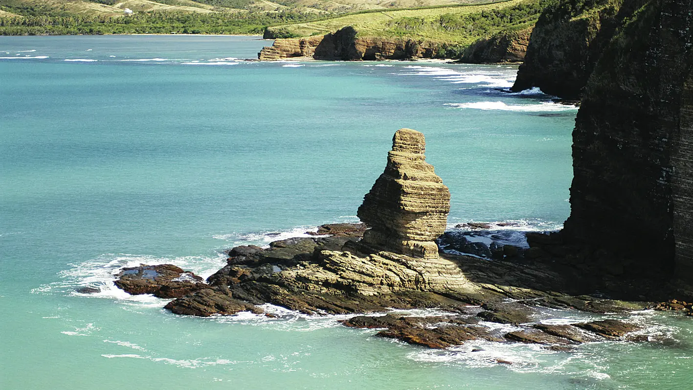
D Car park: head south towards the beach and walk along the base of the cliff (watch out for falling rocks!) in the direction of the “Bonhomme” rock formation. 1 Start of the climb (GPS: 547 253 – 7 610 555): after about 85 m, you’ll see the start of a very steep trail to your right (west) that climbs up the rocky embankment. Navigate the twists and turns and you’ll emerge at the summit of the cape (on the left is the former lookout but there's no entry because the rock fall risk is too high. The rocky cliff has been affected by substantial erosion). 2 Intersection: on the right, there's a path that leads to Notre-Dame-des-Flots (a bit further on you’ll see the old lighthouse that marked the entrance to the Bourail Pass. In Melanesian tradition, La Roche Percée is the gateway to the underwater kingdom of the dead, with the deceased diving from the lookout). Walk down the south-west side of the promontory (there are several beautiful views of Turtle Bay through the curtain of pine trees). Cross the platform straight ahead and join the trail to the left of the information board. Walk down the vegetation-covered slope that overlooks the bay (with its stunning viewpoints). 3 Turtle Bay (information board) (GPS: 547 030 – 7 610 731): cross the track and the grassed area above the beach (huge pine trees) to reach the trail that winds up the other side. 4 Population of Eugenia bullata (dry forest plant with white flowers and red berries): the twists and turns get shorter and shorter. Emerge onto the main track. Go left and follow the edge of the cliff for about 180 m (take care). 5 Fork (GPS: 546 804 – 7 610 728): leave the track and follow the left trail down the embankment. It gradually loses altitude as it winds down the side of the hill. 6 Population of Acropogon bullata (dry forest shrub): after a few steep twists and turns at the bottom of the slope, cross a small creek and then turn left. > A path leads south to Lovers’ Bay nearby. 7 Fork (GPS: 546 557 – 7 610 835): just after the strangler fig, turn right and prepare to tackle a new winding climb to reach your final bay. 8 Fork: cross the dry creek heading south and come out in the long grass. Follow the contour line. 9 Promontory (GPS: 547 348 – 7 610 686 ): the trail then emerges at the top of a cliff (with stunning views of the three bays, Poé Lagoon and the Bourail Pass, a spot enjoyed by surfers). Follow the same route back. © Text by Jean Francis Clair FFrandonnée® grading * Effort: IBP 16 easy (green) * Technical difficulty: quite easy (light blue) * Risk: quite low (orange) * Overall grading: quite low (orange)
Read more
Plain text period
All year round.
Services
Car park
Free car park
Documentation
WPT sentier des Trois Baies
Fiche descriptive
Environment
Beach within 300 m
Sea view
On the premises
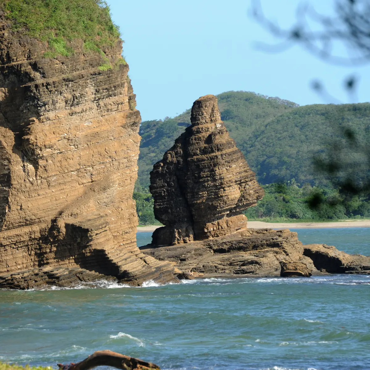
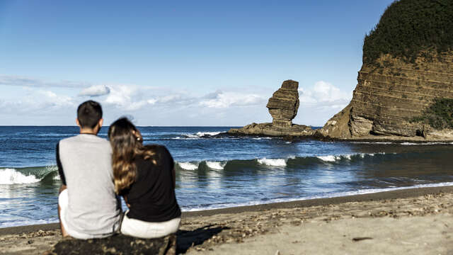
Bonhomme de Bourail
The region's emblem and one we never tire of seeing and photographing from the beach at La Roche Percée or Turtle Bay.
Bourail
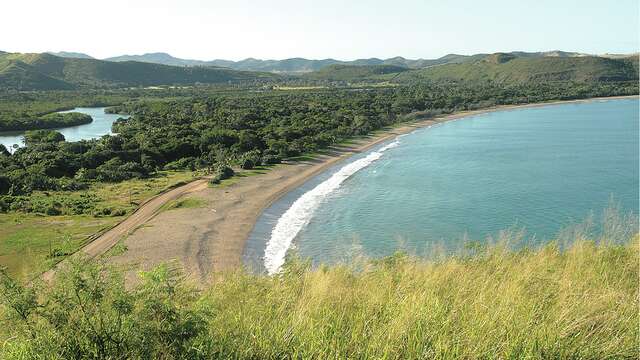
Turtle's Bay
Surrounded by pine trees and lulled by the sound of waves, Turtle Bay is a beautiful, peaceful beach that is well worth a visit.
Bourail
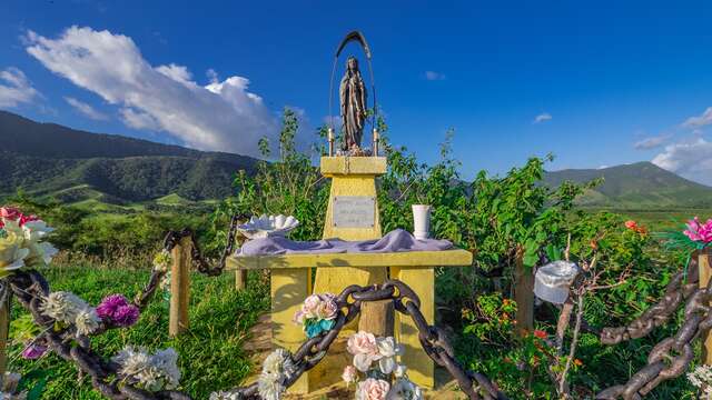
Notre-Dame-des-Flots
Notre-Dame-des-Flots faces the sea from a hill overlooking Gouaro Bay, watching over the boats. It was a highly strategic site during the prison era, as it allowed you to see...
Bourail
Lover's bay
This bay is surrounded by greenery and a great place for people walking along the Three Bays Trail to rest and picnic in peace.
Bourail
Roche Percée beach
Anyone who loves surfing and beautiful scenery will be wowed by this iconic New Caledonian beach!
Bourail
Botanical Trail of the Forest of Cycas
This small family botanical circuit is located in the heart of a registered site. It winds through a beautiful preserved dry forest, then through a dense and shaded mangrove....
Bourail
Close
Popular searches
{% label %}
Filter search
Filter search
Tourist Offers
Business Offers
Page types
All
Articles
Agenda
Lists
Aucun résultat
/
Anglais
Français
日本語
Trade & Médias
Close
×