Aller au contenu principal
Weather
Map
GB
Voir les favoris
en
New Caledonia Tourism: The official website for tourism in New Caledonia
Discover the archipelago
Aerial view of Nouméa, New Caledonia
©
Aerial view of Nouméa, New Caledonia
Nouméa
Top experiences in Nouméa
Amédée Lighthouse
Tjibaou Cultural Centre
Nouméa's bays
Aquarium des Lagons
All things to do and see in Nouméa
Kiki Beach, Lifou
©
Kiki Beach, Lifou
The Islands
Top island experiences
Isle of Pines
Ouvéa
Lifou
Maré
All things to do and see in The Islands
Cattle return to the Néméara farm, Bourail
©
Cattle return to the Néméara farm, Bourail
West coast
Top West Coast experiences
Bourail
La Foa - Farino
Koné - Voh - Pouembout
Poum - Koumac
All things to do and see on the West Coast
Linderalic rocks, Hienghène
©
Linderalic rocks, Hienghène
East Coast
Top East Coast experiences
Hienghène
Poindimié
Thio
Hienghene’s hen and rock formations
All things to do and see on the East Coast
Bivouac at the Blue River Park, Yaté
©
Bivouac at the Blue River Park, Yaté
Great South
Top Great South Experiences
Yaté
Mont-Dore
Blue River Provincial Park
Casy islet
All things to do and see in the Great South
Must-see places
Geography & biodiversity
History of the archipelago
11 reasons to come
Activities
Snorkeling with a lagoon turtle
©
Snorkeling with a lagoon turtle
Heavenly lagoon
Beaches and islets
Diving
Snorkelling
Whale watching
Sailing and navigation
Preserved natural spaces
Birdwatching at the Parc des Grandes Fougères
©
Birdwatching at the Parc des Grandes Fougères
Preserved nature
Hiking, walking, trail running
Boardsports
Horse Riding
Mountain biking and cycling
Scenic flights
Kayaking
Traditional Kanak dancers
©
Traditional Kanak dancers
Authentic cultures
Kanak culture
Bush culture
Local Art
Museums
Heritage
Not-to-be-missed events
Lobster on the beach facing the lagoon, New Caledonia
©
Lobster on the beach facing the lagoon, New Caledonia
Local gastronomy
Local produce
Local cuisine
6 dishes to try in New Caledonia
Where to eat Bougna?
Relaxing in front of the lagoon on the Isle of Pines
©
Relaxing in front of the lagoon on the Isle of Pines
Leisure and relaxation
Nightlife
Spa and wellness
Golf
Romance
Top relaxing experiences
Cruise
Family
Inspiration
Top 50 experiences
Plan your trip
Accommodation
Hotels
Gîtes
Tribal Stays
Youth hostels
Campsites
Eco-responsible
Serviced apartments
All accommodations
Bar of the Sheraton Deva hotel in Bourail
©
Bar of the Sheraton Deva hotel in Bourail
Bars and restaurants
Road trip to Hienghène, seaside road
©
Road trip to Hienghène, seaside road
Transport
Fête Nationale in Nouméa
©
Fête Nationale in Nouméa
Calendar of Events
Beach of the hotel Paradis d'Ouvéa
©
Beach of the hotel Paradis d'Ouvéa
Special offers
Travel guide
Plan your trip from A to Z
Travel specialist
Passport, visa and customs
Flights to New Caledonia
Airport information
Mobile Internet
Arriving by boat
Money and currency
Health & Safety
Weather and seasons
Traditions
Brochures
F.A.Q
Getting around
Itineraries / Road trip
Homepage
Pedestrian path of Boé Arérédi
Pedestrian path of Boé Arérédi
Sport
Pedestrian sports
Hiking itinerary
Elevation : 172m
Lot 1 Gouaro Déva, 98870 Bourail
Getting there
×
Open the itinerary in
Google Maps
Apple Plans
Waze
Mappy
Share
Ajouter aux favoris
Add to my favorites
×
Share this sheet
Pedestrian path of Boé Arérédi
E-mail
WhatsApp
Facebook
X
LinkedIn
Pinterest
©
JC Robert
©
JC Robert
©
Domaine de Deva
©
Domaine de Deva
©
Domaine de Deva
+ 6
×
©
JC Robert
©
JC Robert
©
Domaine de Deva
©
Domaine de Deva
©
Domaine de Deva
©
Domaine de Deva
©
Domaine de Deva
©
JC Robert
©
JC Robert
©
JC Robert
©
JC Robert
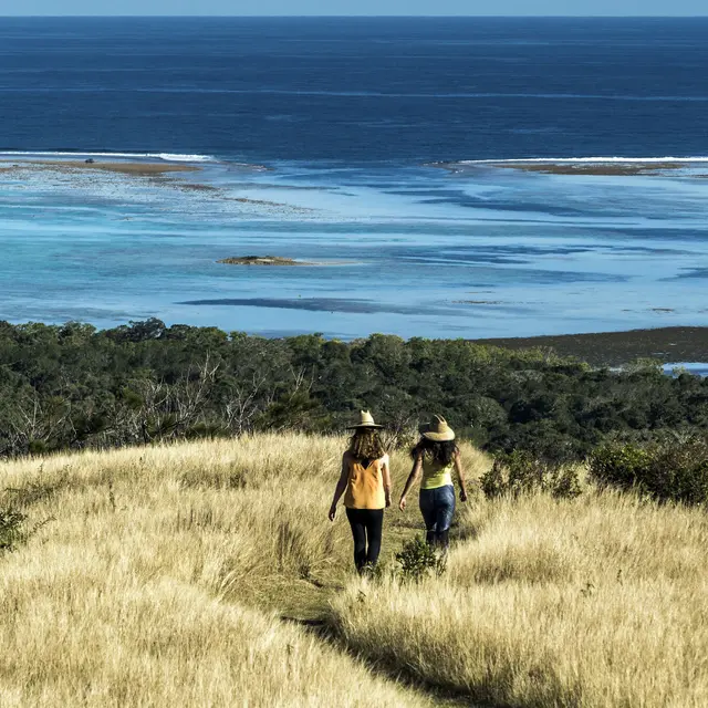
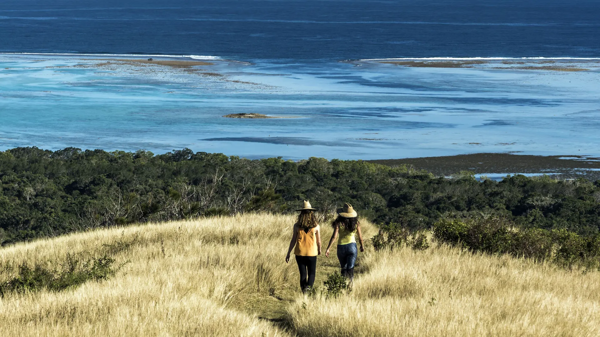
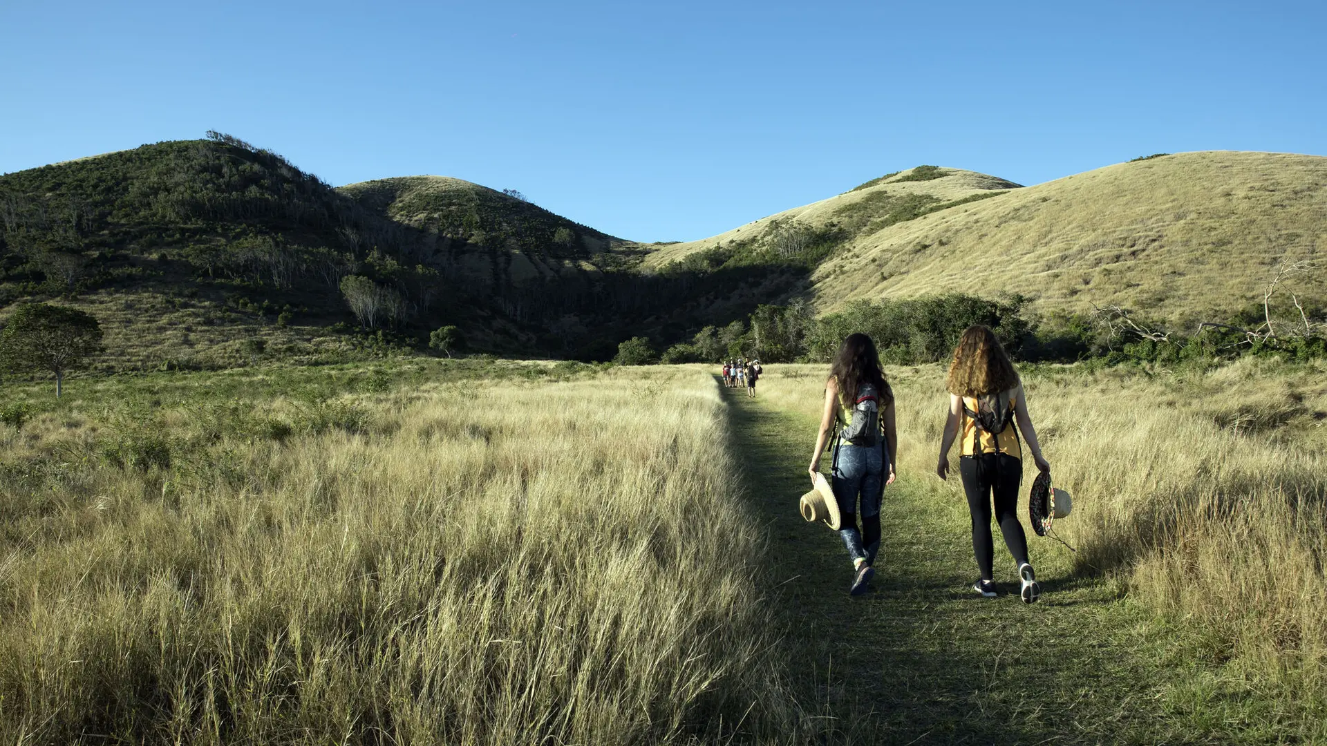
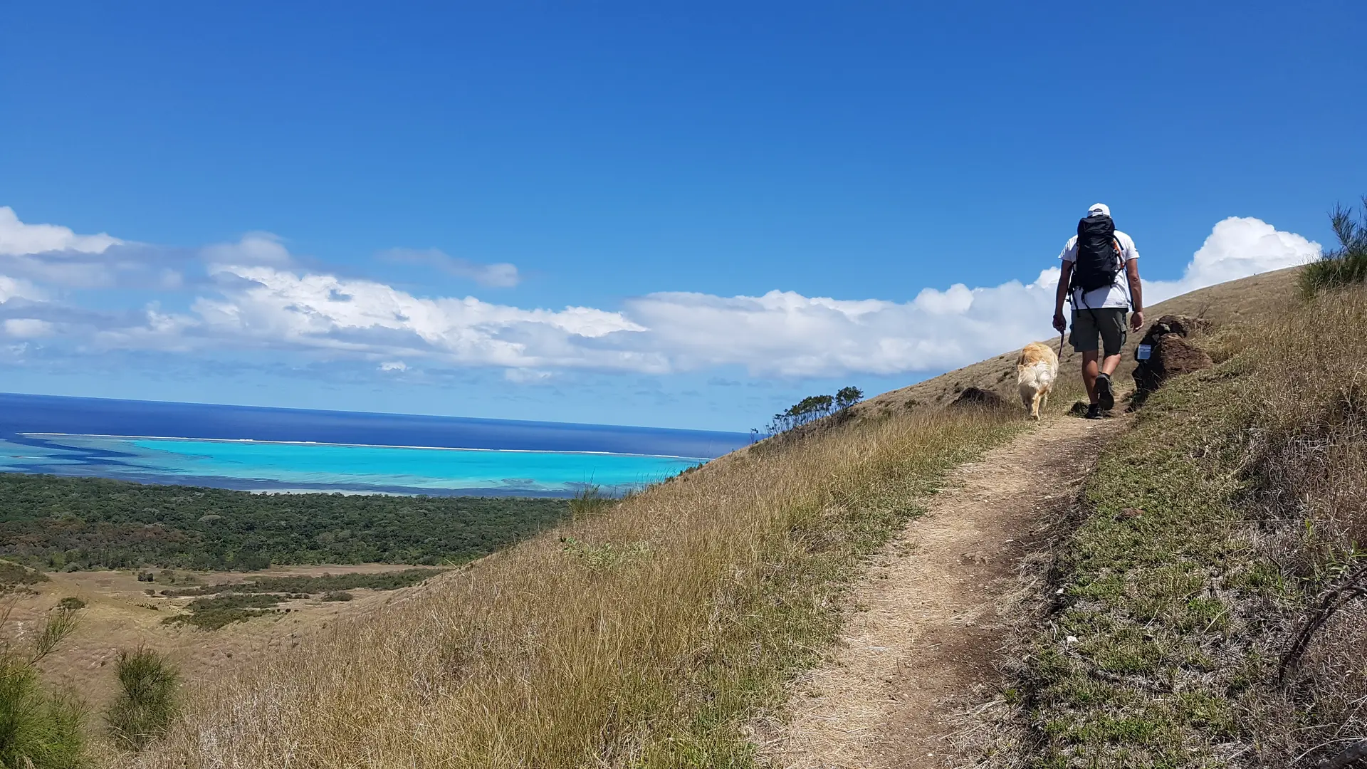
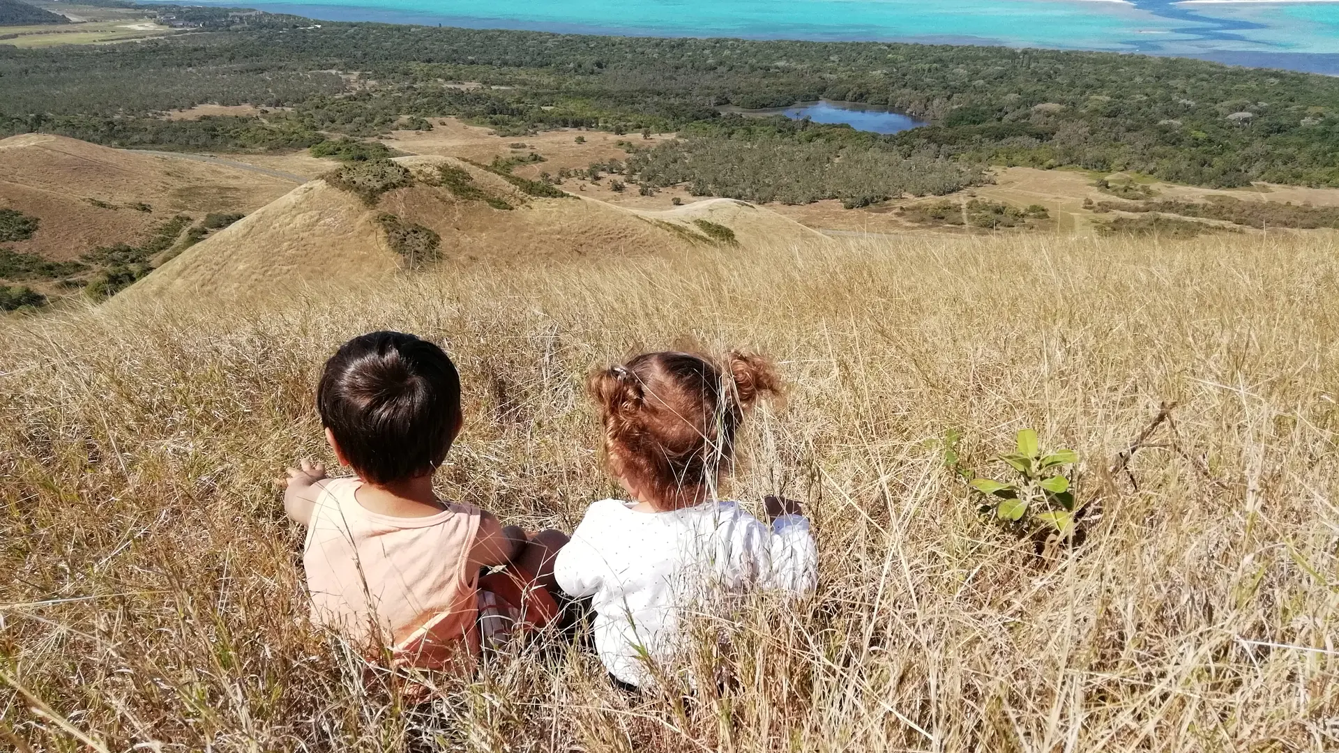
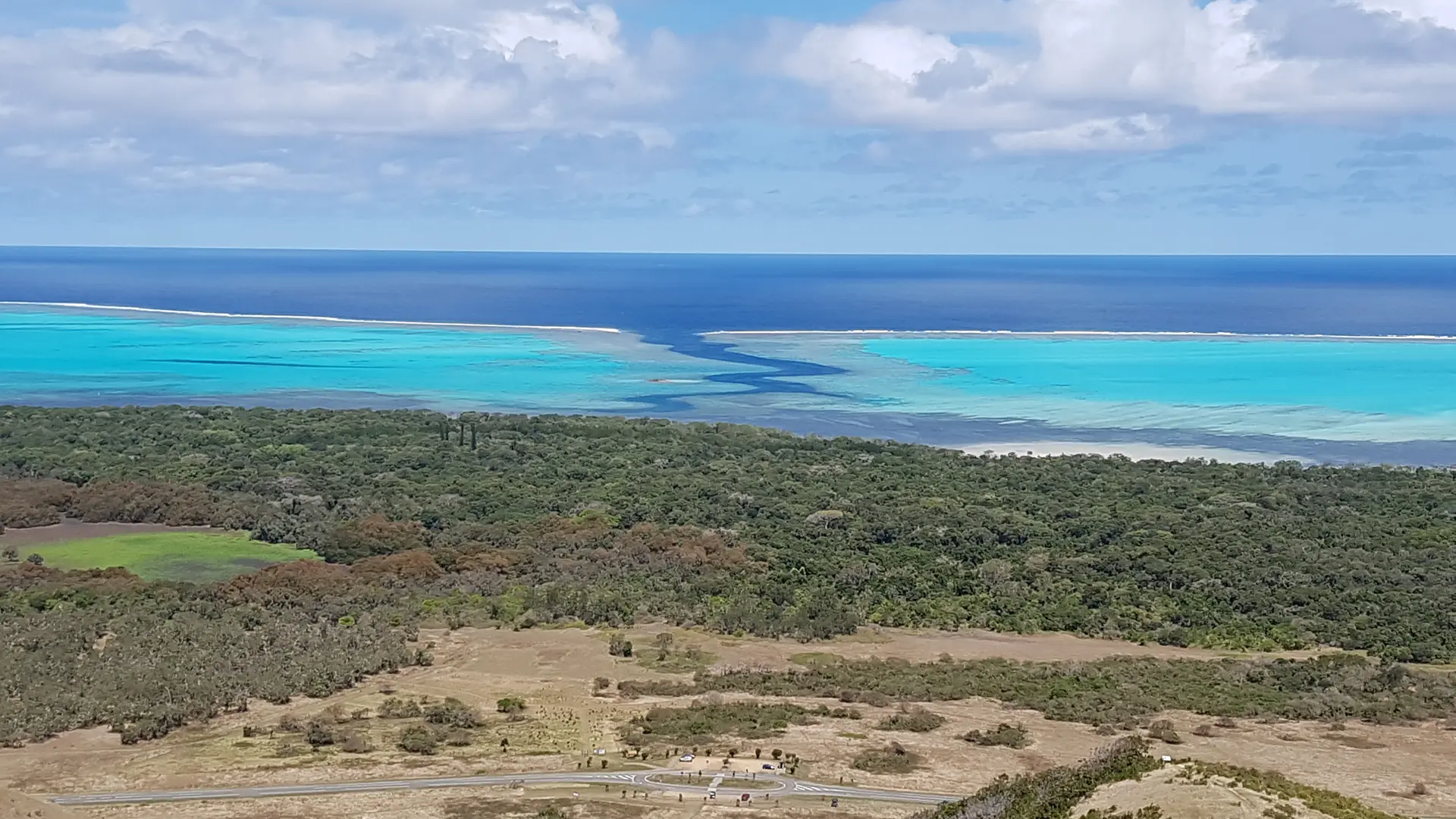
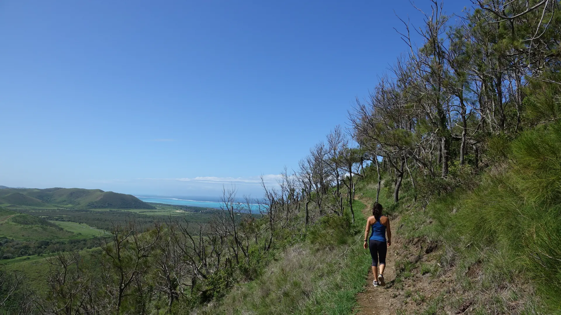
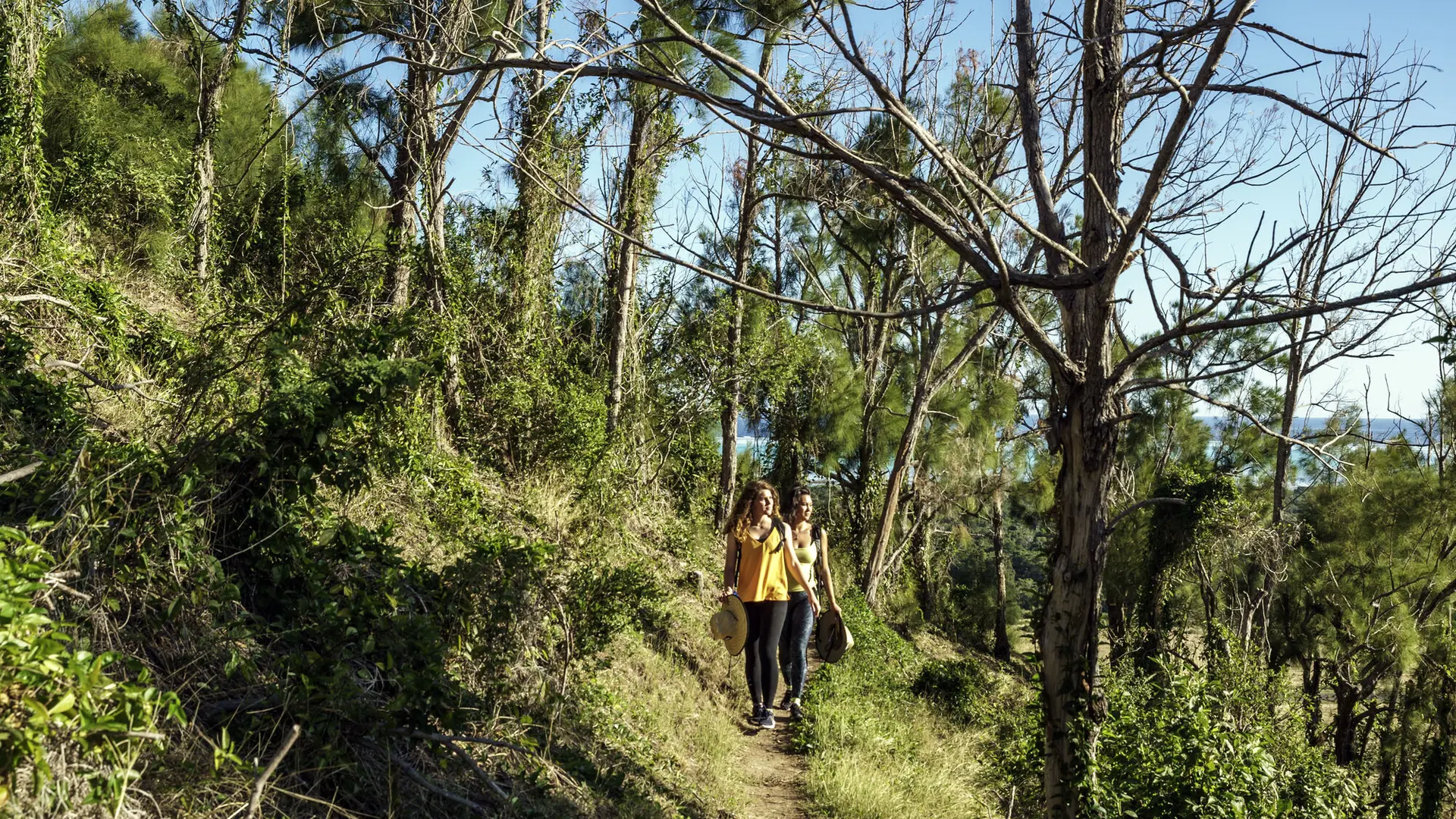
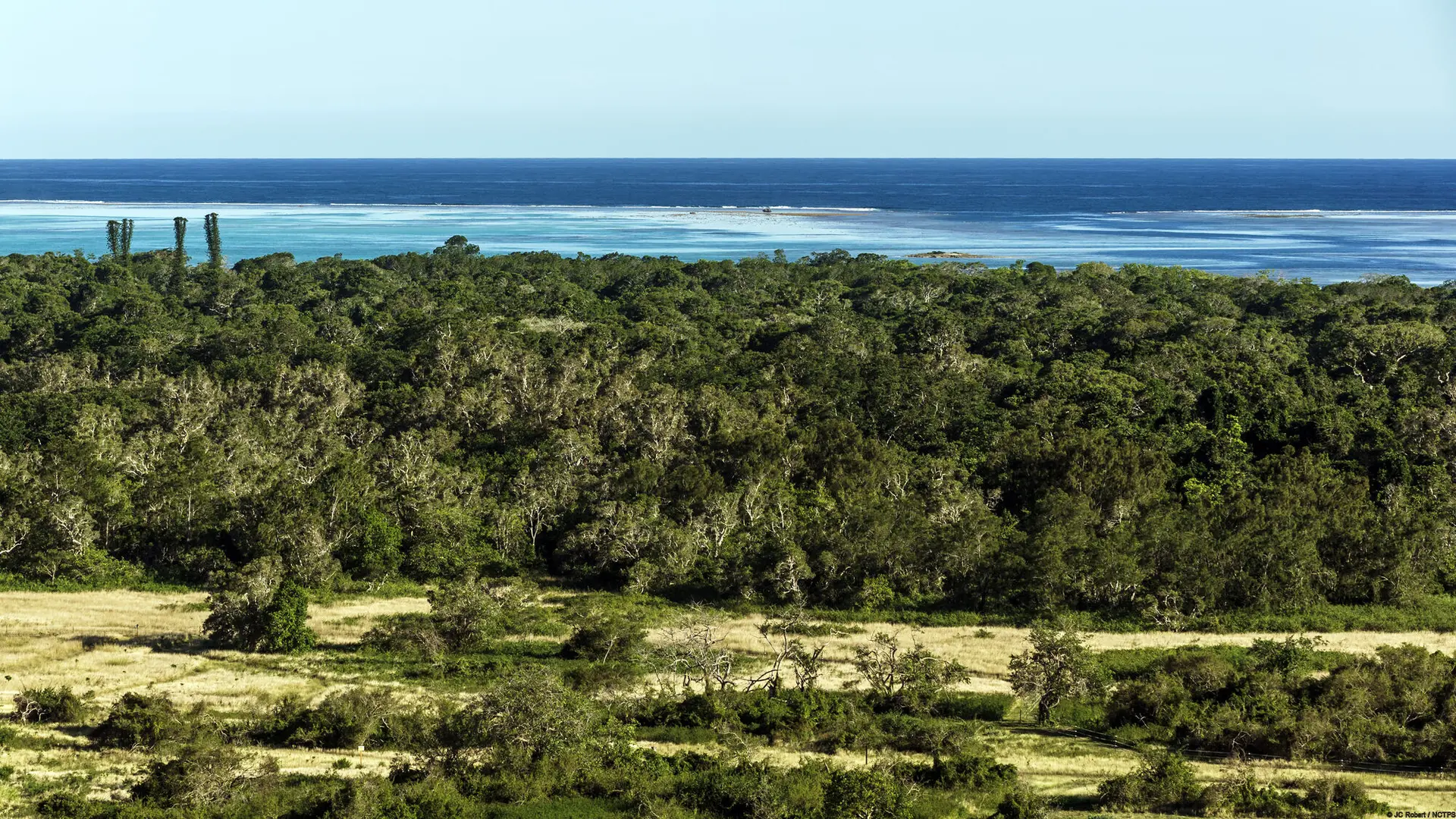
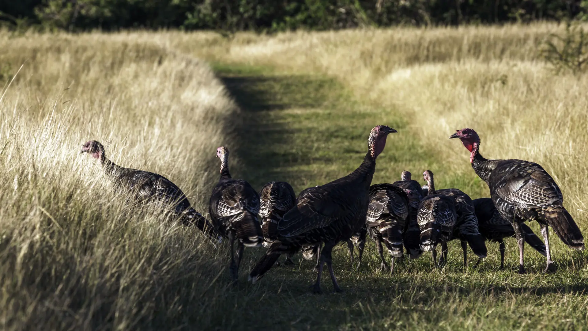
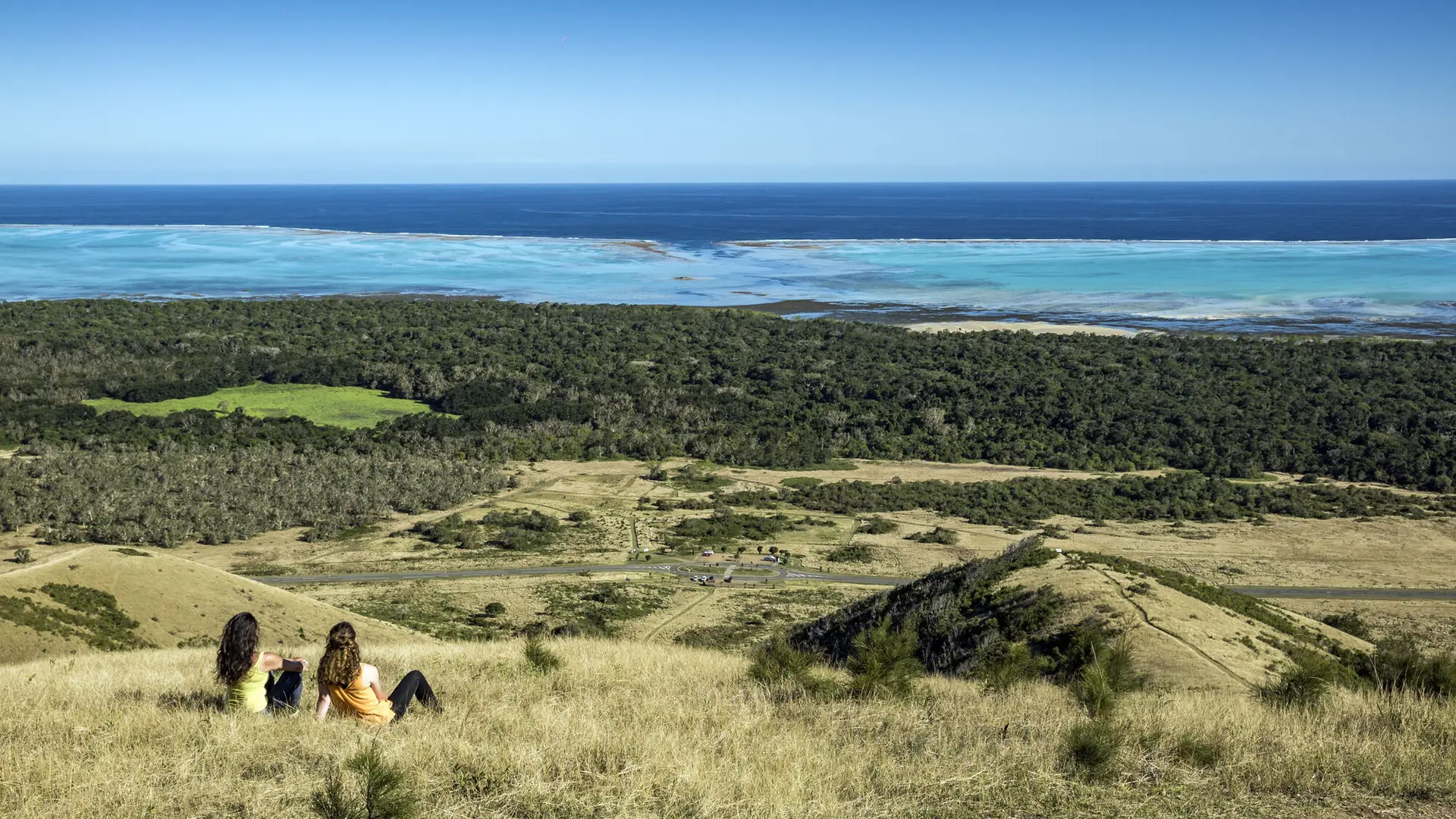
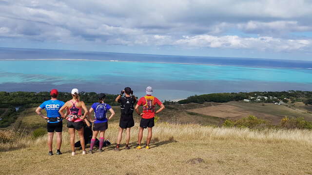
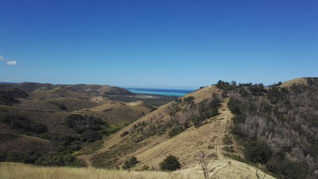
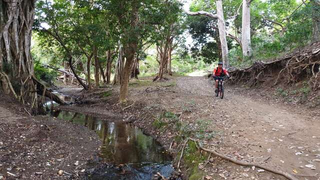
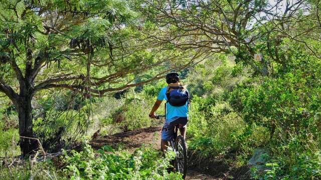
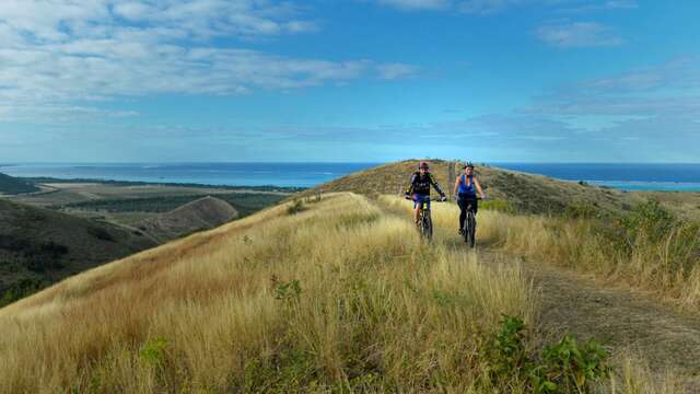
The route follows the edge of the ridges overlooking the Shark Islet "fault" and Fournier Marsh. The landscape glows with a multitude of colors ranging from silvery yellow to shades of green. The horizon opens up to a multitude of hills.
COURSE DESCRIPTION D Starting point (GPS : 535 431 - 7 613 525 ; alt. 13 m / 42 ft) : immediately take a right (east). Follow the vegetated area, between the road and the flank. When you get to the entrance of the valley, turn left northwards and walk on a grassy track down to the valley floor. Reach the beginning of the climb. 1 Banyan (Ficus sp.) (GPS : 535 963 - 7 614 500 ; alt. 38 m / 125 ft) : (this tree is estimated to be 220 years. It is an epiphyte that doesn’t steal its victim’s sap. It simply leans on it, but, little by little, its roots choke out its stake) : start the progressive climb in hairpin bends towards northwest up to the pass. 2 Pass (GPS : 535 622 - 7 614 730 ; alt. 110 m / 360 ft) : continue the ascent due south, following the ridge. The hiking trail alternates between hillside paths and tracks in hairpin bends on one side or the other of the ridge, until you get to the first lookout. 3 Lookout (GPS : 535 675 - 7 614 340 ; alt. 148 m / 485 ft) : keep on walking southwards , and then towards southwest, till you reach the summit. 4 Lookout (GPS : 535 514 - 7 614 147 ; alt. 185 m / 606 ft) (bench, view on the blue ribbon drawn by the Shark Island channel in the axis of the ridge, « Faille de l’îlot Shark » information sign - « Fault of the Shark Island »): begin the descent in hairpins towards southwest down to the next lookout (respect the track in hairpins, so as not to accelerate soil erosion or damage the vegetation). 5 Lookout (GPS : 535 401 - 7 613 849 ; alt. 104 m / 341 ft) (« Marais et forêts » information sign) : continue walking down, first westwards and then southwards, till you reach the entrance of the small valley, from where you can see the car park below. Text © Explorenc (Jean Francis et Delphine Clair) FFrandonnée® rating : effort IBP 26 quite easy • Technicity 2 quite easy • Risk 2 quite low
Read more
Plain text period
All year round between 6.30 am and 7 pm.
Subject to favorable weather.
Services
Public WC
Car park
Sustainable development
Outhouse
Free car park
Pets welcome
Documentation
Hiking Guide
Fiche descriptive
Environment
In the country
Sea view
Panoramic view
On the premises
Deva Domain
This site is exceptional both in terms of its biodiversity and the beauty of its landscapes. A wide range of activities are on offer for nature lovers, providing them with a...
Bourail
Pedestrian path of Oua Koué
The airy and bright route overhangs the seaside, whose reef and lagoon have been inscribed in Unesco’s World Heritage List. The areas it crosses are steeped in distant history....
Bourail
Sentier pédestre de la Forêt des Origines au Lagon
The path runs through spaces whose history dates back almost three millennia; the lands of the customary chiefdoms and clans of the Ara and Arô territories. The people of Ara,...
Bourail
Pedestrian Path of the Giants
Lurking between the sea and some hills, under the foliage of one of the last dry forests of New-Caledonia, the Fournier marsh of Poé conceals uncommon natural spectacles. A...
Bourail
Children's playground in Deva
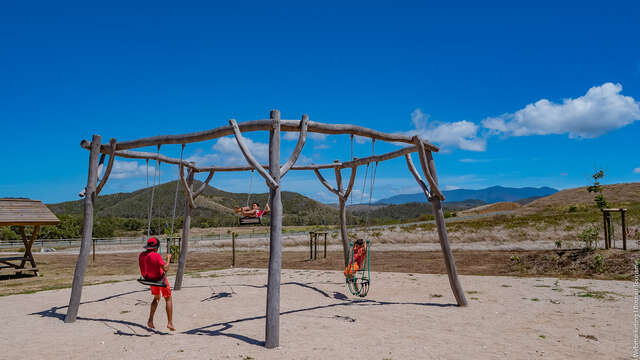
The Domaine de Deva playground is a new addition to the wide range of fun and family activities already present on the estate.
Bourail
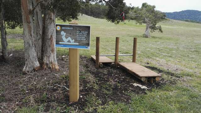
Deva's health course
The health trail of the Deva estate is an itinerary suitable for the whole family and allows its users to exercise in the heart of the Caledonian dry forest.
Bourail
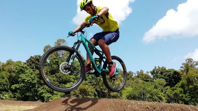
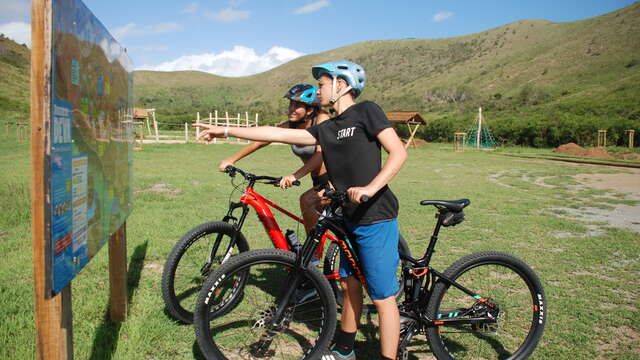
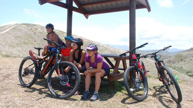
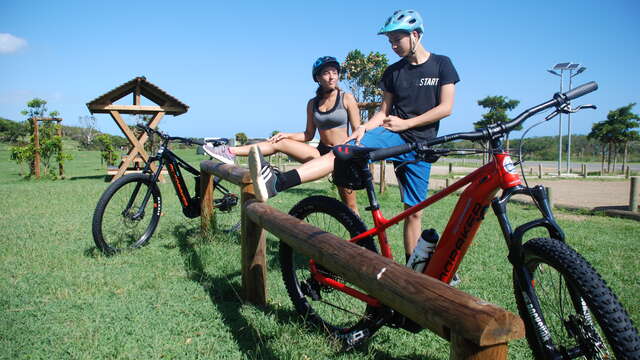
Deva Bike Park
With its bike park, the Deva estate invites beginners and experienced mountain bikers to come and have fun and progress on its two pump tracks. A total of 500 meters of track...
Bourail
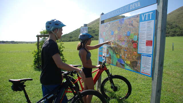
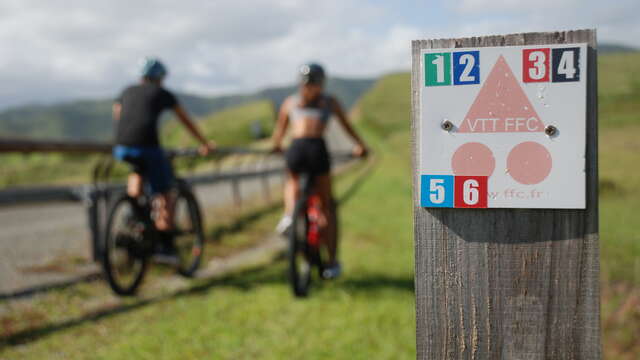
Mountain Bike Trail n.1 green "No Poradéno"
Nice easy loop to do by mountain bike on the Domaine de Deva, with a distance of 8,6km, duration of 1h15, +123m of difference in altitude.
Bourail
Mountain Bike Trail n.2 blue "No Bouaou"
Nice loop to do by mountain bike on the Domaine de Deva, 12.3km for a duration of 1h30 and a difference in altitude of 200m.
Bourail
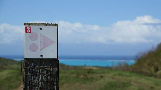
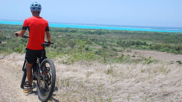
Moutain Bike Trail n.3 red "Bouencoy"
Very difficult mountain bike loop to be done on the Domain of Deva, of 16Km for a duration of 2h20 and a difference in altitude of 490m.
Bourail
Mountain Bike Trail n.4 black « Zouvézélé »
Mountain bike loop for experts to be done on the Domaine de Deva, of 20,7Km for a duration of 3H and a difference in altitude of 764m.
Bourail
Mountain Bike Trail n.5 "Flat Forest"
Moderate loop to be done by mountain bike on the Domaine de Deva, duration 1h30, of 10km with 155m of difference in altitude.
Bourail
Mountain Bike Trail n.6 red "Me Awi"
Mountain bike loop quite difficult to make on the Domain of Deva, of 15Km for a duration of 2H and a difference in altitude of 324m.
Bourail
Mountain Bike Trail n.7 green "Marais de Déva"
Entirely flat and very easy level mountain bike circuit suitable for the whole family.
Bourail
Mountain Bike Trail n.8 blue "Temrock"
An easy mountain bike route that highlights the varied landscapes of the Domaine de Deva, making it accessible to mountain bikers of all levels.
Bourail
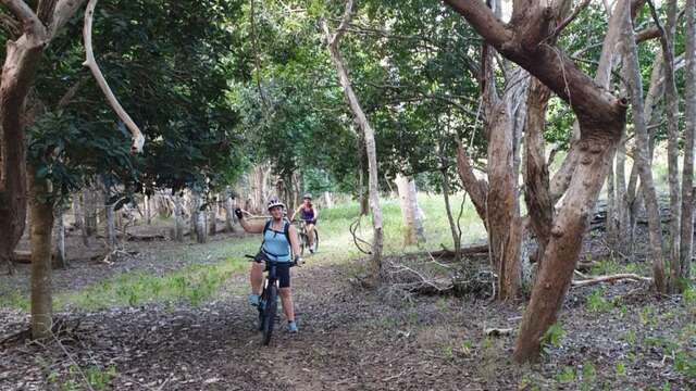
Mountain Bike Trail n.9 blue "Rivière de Déva"
Medium level mountain bike trail that follows the Deva River through a beautiful valley away from the rest of the estate.
Bourail
Mountain Bike Trail n.10 red "No Pouméi"
A 28km mountain bike trail in the middle of nature, more suitable for experienced cyclists, especially because of the positive difference in altitude of this route.
Bourail
Mountain Bike Trail n.11 blue "Nindoua"
Blue mountain bike trail "Nindoua", numbered "11" on the general map.
Bourail
Mountain Bike Trail n.12 red "Taveou"
This difficult trail will give you a taste of the joys and technique of a gentle ascent through smoothly traced switchbacks.
Bourail
Close
Popular searches
{% label %}
Filter search
Filter search
Tourist Offers
Business Offers
Page types
All
Articles
Agenda
Lists
Aucun résultat
/
Anglais
Français
日本語
Trade & Médias
Close
×