Aller au contenu principal
Weather
Map
GB
Voir les favoris
en
New Caledonia Tourism: The official website for tourism in New Caledonia
Discover the archipelago
Aerial view of Nouméa, New Caledonia
©
Aerial view of Nouméa, New Caledonia
Nouméa
Top experiences in Nouméa
Amédée Lighthouse
Tjibaou Cultural Centre
Nouméa's bays
Aquarium des Lagons
All things to do and see in Nouméa
Kiki Beach, Lifou
©
Kiki Beach, Lifou
The Islands
Top island experiences
Isle of Pines
Ouvéa
Lifou
Maré
All things to do and see in The Islands
Cattle return to the Néméara farm, Bourail
©
Cattle return to the Néméara farm, Bourail
West coast
Top West Coast experiences
Bourail
La Foa - Farino
Koné - Voh - Pouembout
Poum - Koumac
All things to do and see on the West Coast
Linderalic rocks, Hienghène
©
Linderalic rocks, Hienghène
East Coast
Top East Coast experiences
Hienghène
Poindimié
Thio
Hienghene’s hen and rock formations
All things to do and see on the East Coast
Bivouac at the Blue River Park, Yaté
©
Bivouac at the Blue River Park, Yaté
Great South
Top Great South Experiences
Yaté
Mont-Dore
Blue River Provincial Park
Casy islet
All things to do and see in the Great South
Must-see places
Geography & biodiversity
History of the archipelago
11 reasons to come
Activities
Snorkeling with a lagoon turtle
©
Snorkeling with a lagoon turtle
Heavenly lagoon
Beaches and islets
Diving
Snorkelling
Whale watching
Sailing and navigation
Preserved natural spaces
Birdwatching at the Parc des Grandes Fougères
©
Birdwatching at the Parc des Grandes Fougères
Preserved nature
Hiking, walking, trail running
Boardsports
Horse Riding
Mountain biking and cycling
Scenic flights
Kayaking
Traditional Kanak dancers
©
Traditional Kanak dancers
Authentic cultures
Kanak culture
Bush culture
Local Art
Museums
Heritage
Not-to-be-missed events
Lobster on the beach facing the lagoon, New Caledonia
©
Lobster on the beach facing the lagoon, New Caledonia
Local gastronomy
Local produce
Local cuisine
6 dishes to try in New Caledonia
Where to eat Bougna?
Relaxing in front of the lagoon on the Isle of Pines
©
Relaxing in front of the lagoon on the Isle of Pines
Leisure and relaxation
Nightlife
Spa and wellness
Golf
Romance
Top relaxing experiences
Cruise
Family
Inspiration
Top 50 experiences
Plan your trip
Accommodation
Hotels
Gîtes
Tribal Stays
Youth hostels
Campsites
Eco-responsible
Serviced apartments
All accommodations
Bar of the Sheraton Deva hotel in Bourail
©
Bar of the Sheraton Deva hotel in Bourail
Bars and restaurants
Road trip to Hienghène, seaside road
©
Road trip to Hienghène, seaside road
Transport
Fête Nationale in Nouméa
©
Fête Nationale in Nouméa
Calendar of Events
Beach of the hotel Paradis d'Ouvéa
©
Beach of the hotel Paradis d'Ouvéa
Special offers
Travel guide
Plan your trip from A to Z
Travel specialist
Passport, visa and customs
Flights to New Caledonia
Airport information
Mobile Internet
Arriving by boat
Money and currency
Health & Safety
Weather and seasons
Traditions
Brochures
F.A.Q
Getting around
Itineraries / Road trip
Homepage
Netcha Trail
Netcha Trail
Sport
Pedestrian sports
Hiking itinerary
Elevation : 547m
Site de Netcha, 98834 Yaté
Getting there
×
Open the itinerary in
Google Maps
Apple Plans
Waze
Mappy
Share
Ajouter aux favoris
Add to my favorites
×
Share this sheet
Netcha Trail
E-mail
WhatsApp
Facebook
X
LinkedIn
Pinterest
©
@M. Dosdane
©
@J.F. Clair
©
@M. Dosdane
×
©
@M. Dosdane
©
@J.F. Clair
©
@M. Dosdane
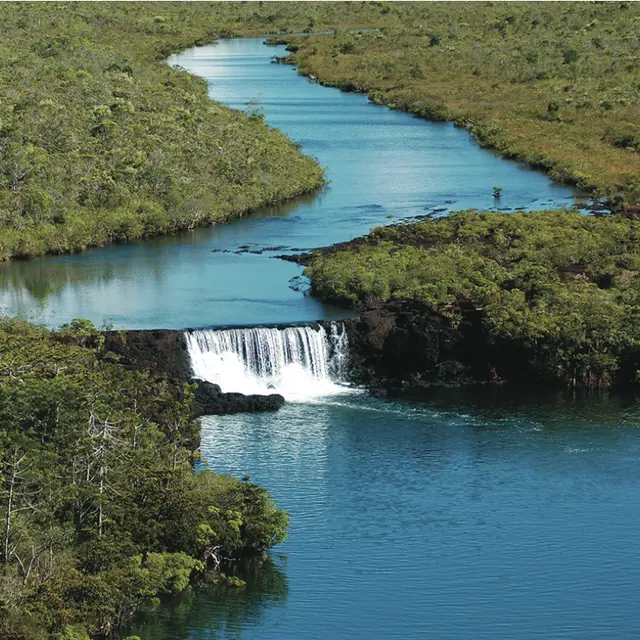
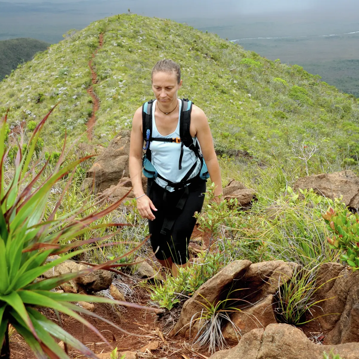
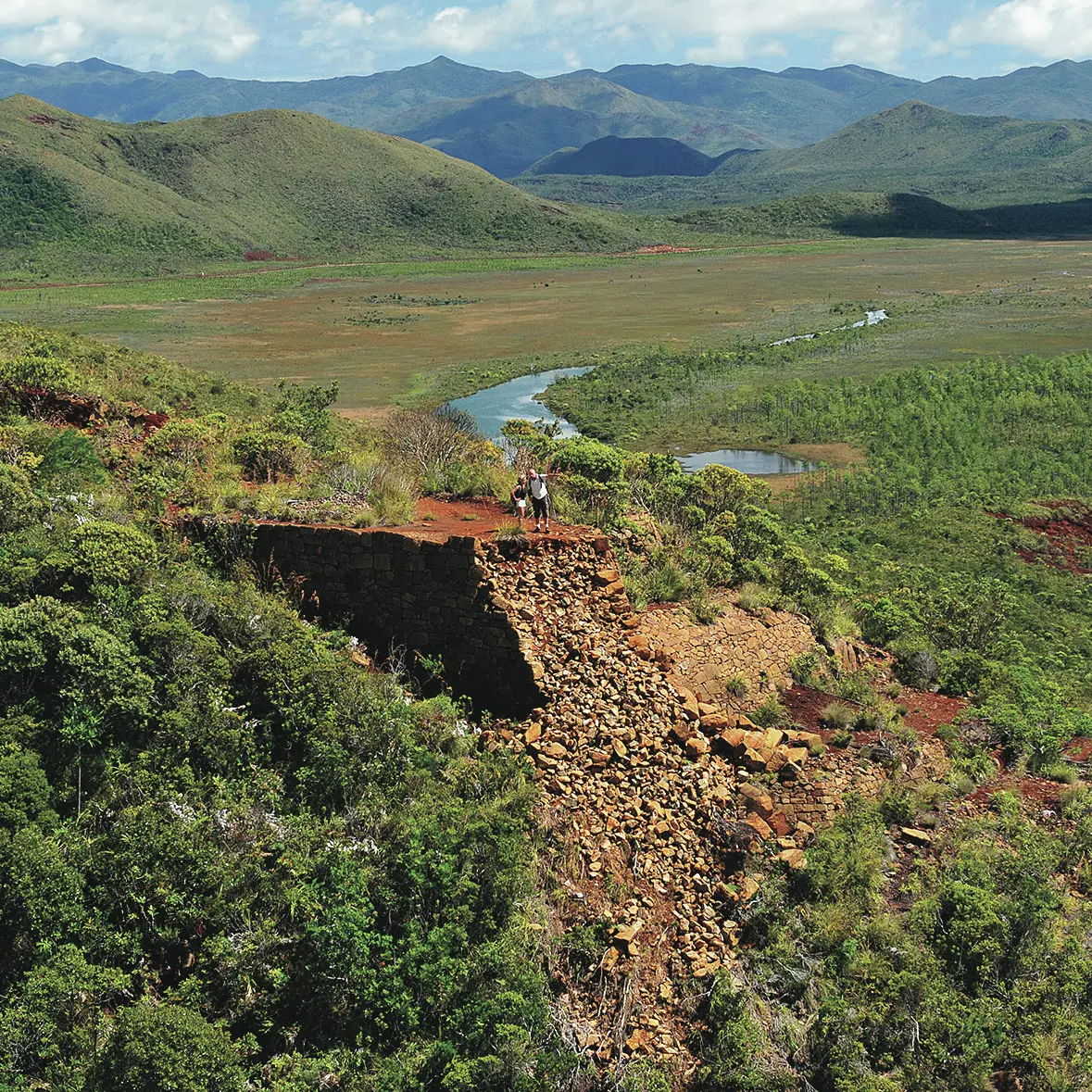
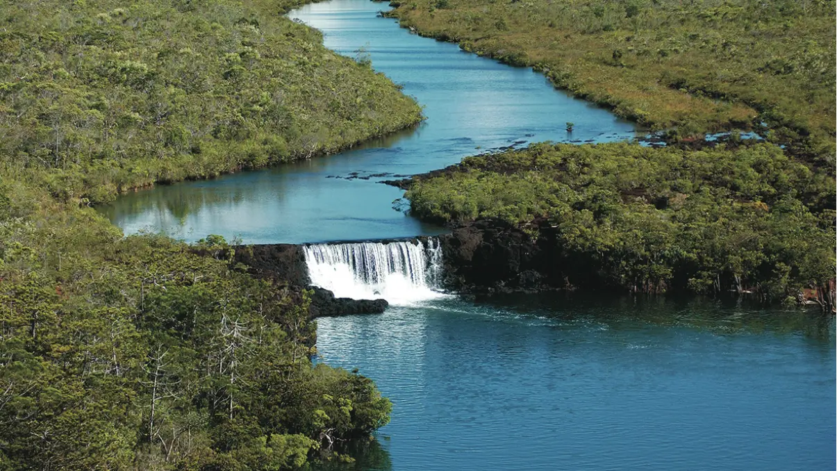
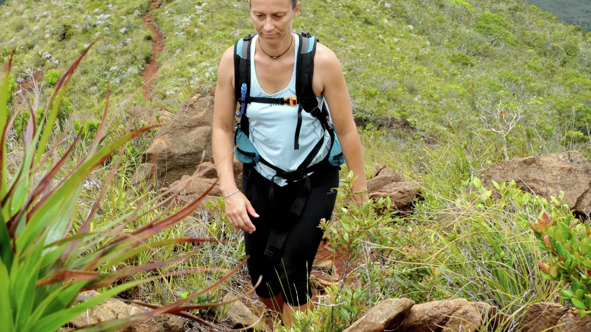
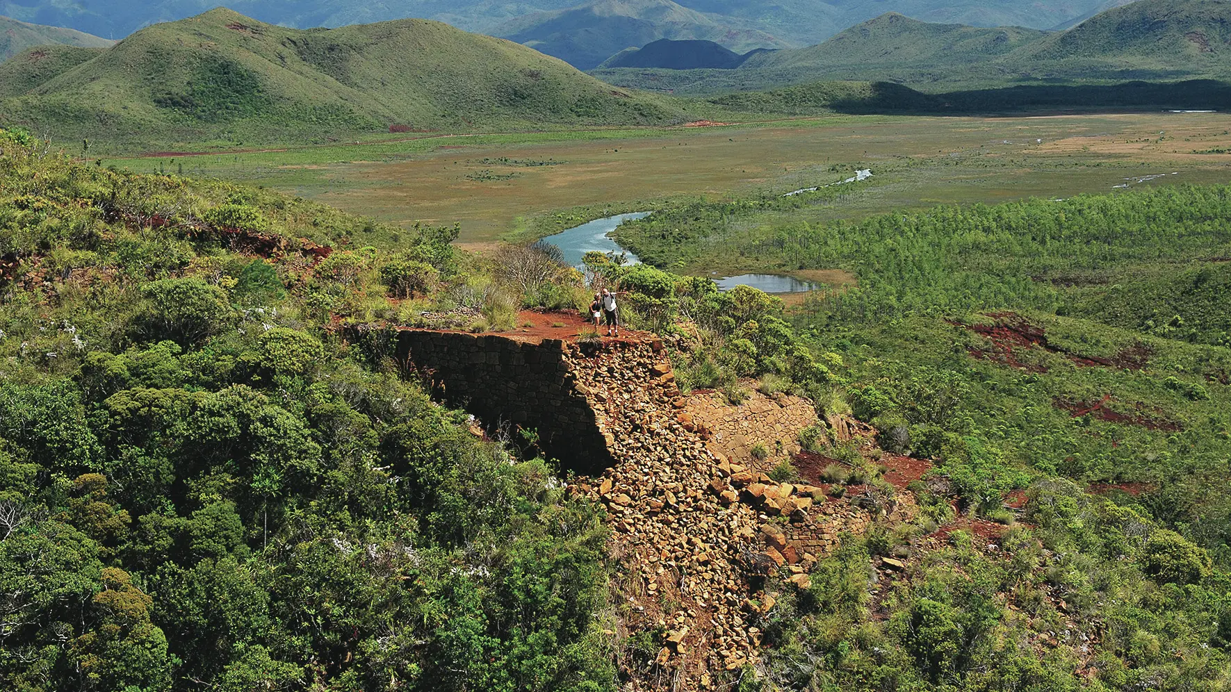
This trail runs along the northern end of the long ridge that stretches from Pic du Pin to the Anna Madeleine Mine, separating the Plain of Lakes from Pernod Creek and the Lower Lakes River Valley.
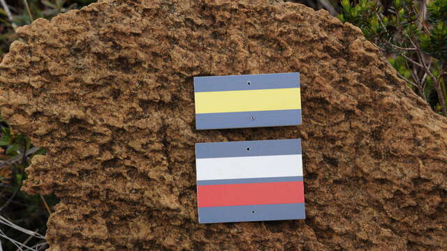
The track shares part of its route with that of the GR® NC1 (white and red marking). D Netcha reception desk (GPS: 690 330 – 7 541 313; alt. 244m): take the path which goes down in the basin towards the south. It then climbs gently towards the road (RM 10). However, a short distance before this, it veers to the left (towards the east) and joins the road further on (slippery ground in wet weather). 1 Road (GPS: 690 602 – 7 541 059; alt. 242m): cross and climb the foothills of red earth (slippery in rainy weather). There is a small change in the terrain. 2 Hillock (GPS: 690 647 – 7 540 988; alt. 267m) (lookout point over the river and the surrounding area): cross the saddle of red earth and resume the ascent. 3 Intersection (GPS: 690 596 – 7 540 871; alt. 284m): go straight ahead (the path, on the left, is the Agathis path that joins the Madeleine botanical reserve). The path continues its gentle ascent on the mountainside. It heads towards an old mining operation. 4 Anna-Madeleine Mine (GPS: 690 530 – 7 540 322; alt. 36m): (be careful, the promontory that served as the start of the funicular is unstable. Landslides sometimes occur): continue the climb north-west and reach a ridge (alt. 403m). The route continues west and follows the long rising ridge line. It crosses several shoulders and arrives at the highest point of the track (during the entire ascent of the ridge, you get beautiful views on the Plaine des Lacs). Head down the small saddle. 5 Fork (GPS: 688 364 – 7 540 154; alt. 544m): leave the GR® NC1 and turn right towards the north-west to follow the course of the small ridge for a while (beautiful views) to the landing zone for helicopters. 6 Helipad (GPS: 688 129 – 7 540 886; alt. 527m): the path then engages in several zigzags to descend towards the pass where it joins the route of the GR® NC1. 7 Pass (GPS: 688 444 – 7 541 339; alt. 381 m): turn right and follow the pleasant mule track which descends to the gently sloping plain. At the bottom of the slope, the path crosses a pine plantation and leads to the RM 10. 8 Road (GPS: 689 803 – 7 541 389; alt. 245m): cross and head slightly to the right to find the path on the other side. Return to starting point D. © Text by Jean Francis Clair FFrandonnée® grading * Effort: IBP 49 Fairly easy (light blue) * Technical difficulty: Fairly easy (light blue) * Risk: Fairly low (light blue) * Overall score: Fairly easy (light blue)
Read more
Plain text period
All year round.
Services
Picnic area
Covered picnic area
Barbecue
Sustainable development
Outhouse
Documentation
WPT Netcha
Fiche descriptive
On the premises
GR® NC1 Stage n°3: from Netcha to Ouénarou refuge
Following in the footsteps of the pack animals that tirelessly roamed the Deep South to supply prospectors, miners or foresters, you will cross the strange valley of Pernod...
Mont-Dore
The Netcha Loops
The trails are freely accessible, the starting points are located all along the Route du Carénage. There is no mountain bike rental on site, please bring your own mountain bike...
Yaté
Close
Popular searches
{% label %}
Filter search
Filter search
Tourist Offers
Business Offers
Page types
All
Articles
Agenda
Lists
Aucun résultat
/
Anglais
Français
日本語
Trade & Médias
Close
×