Aller au contenu principal
Weather
Map
GB
Voir les favoris
en
New Caledonia Tourism: The official website for tourism in New Caledonia
Discover the archipelago
Aerial view of Nouméa, New Caledonia
©
Aerial view of Nouméa, New Caledonia
Nouméa
Top experiences in Nouméa
Amédée Lighthouse
Tjibaou Cultural Centre
Nouméa's bays
Aquarium des Lagons
All things to do and see in Nouméa
Kiki Beach, Lifou
©
Kiki Beach, Lifou
The Islands
Top island experiences
Isle of Pines
Ouvéa
Lifou
Maré
All things to do and see in The Islands
Cattle return to the Néméara farm, Bourail
©
Cattle return to the Néméara farm, Bourail
West coast
Top West Coast experiences
Bourail
La Foa - Farino
Koné - Voh - Pouembout
Poum - Koumac
All things to do and see on the West Coast
Linderalic rocks, Hienghène
©
Linderalic rocks, Hienghène
East Coast
Top East Coast experiences
Hienghène
Poindimié
Thio
Hienghene’s hen and rock formations
All things to do and see on the East Coast
Bivouac at the Blue River Park, Yaté
©
Bivouac at the Blue River Park, Yaté
Great South
Top Great South Experiences
Yaté
Mont-Dore
Blue River Provincial Park
Casy islet
All things to do and see in the Great South
Must-see places
Geography & biodiversity
History of the archipelago
11 reasons to come
Activities
Snorkeling with a lagoon turtle
©
Snorkeling with a lagoon turtle
Heavenly lagoon
Beaches and islets
Diving
Snorkelling
Whale watching
Sailing and navigation
Preserved natural spaces
Birdwatching at the Parc des Grandes Fougères
©
Birdwatching at the Parc des Grandes Fougères
Preserved nature
Hiking, walking, trail running
Boardsports
Horse Riding
Mountain biking and cycling
Scenic flights
Kayaking
Traditional Kanak dancers
©
Traditional Kanak dancers
Authentic cultures
Kanak culture
Bush culture
Local Art
Museums
Heritage
Not-to-be-missed events
Lobster on the beach facing the lagoon, New Caledonia
©
Lobster on the beach facing the lagoon, New Caledonia
Local gastronomy
Local produce
Local cuisine
6 dishes to try in New Caledonia
Where to eat Bougna?
Relaxing in front of the lagoon on the Isle of Pines
©
Relaxing in front of the lagoon on the Isle of Pines
Leisure and relaxation
Nightlife
Spa and wellness
Golf
Romance
Top relaxing experiences
Cruise
Family
Inspiration
Top 50 experiences
Plan your trip
Accommodation
Hotels
Gîtes
Tribal Stays
Youth hostels
Campsites
Eco-responsible
Serviced apartments
All accommodations
Bar of the Sheraton Deva hotel in Bourail
©
Bar of the Sheraton Deva hotel in Bourail
Bars and restaurants
Road trip to Hienghène, seaside road
©
Road trip to Hienghène, seaside road
Transport
Fête Nationale in Nouméa
©
Fête Nationale in Nouméa
Calendar of Events
Beach of the hotel Paradis d'Ouvéa
©
Beach of the hotel Paradis d'Ouvéa
Special offers
Travel guide
Plan your trip from A to Z
Travel specialist
Passport, visa and customs
Flights to New Caledonia
Airport information
Mobile Internet
Arriving by boat
Money and currency
Health & Safety
Weather and seasons
Traditions
Brochures
F.A.Q
Getting around
Itineraries / Road trip
Homepage
Dogny Plateau Trail
Dogny Plateau Trail
Sport
Pedestrian sports
Hiking itinerary
Trail route
Elevation : 1055m
Sarraméa, 98882 Sarraméa
Getting there
×
Open the itinerary in
Google Maps
Apple Plans
Waze
Mappy
Share
Ajouter aux favoris
Add to my favorites
×
Share this sheet
Dogny Plateau Trail
E-mail
WhatsApp
Facebook
X
LinkedIn
Pinterest
©
M. Dosdane / NCT
©
@J.F. Clair
©
@J.F. Clair
©
J.F. Clair
×
©
M. Dosdane / NCT
©
@J.F. Clair
©
@J.F. Clair
©
J.F. Clair
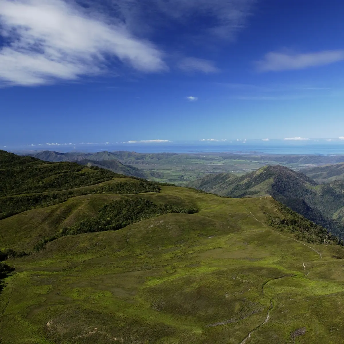
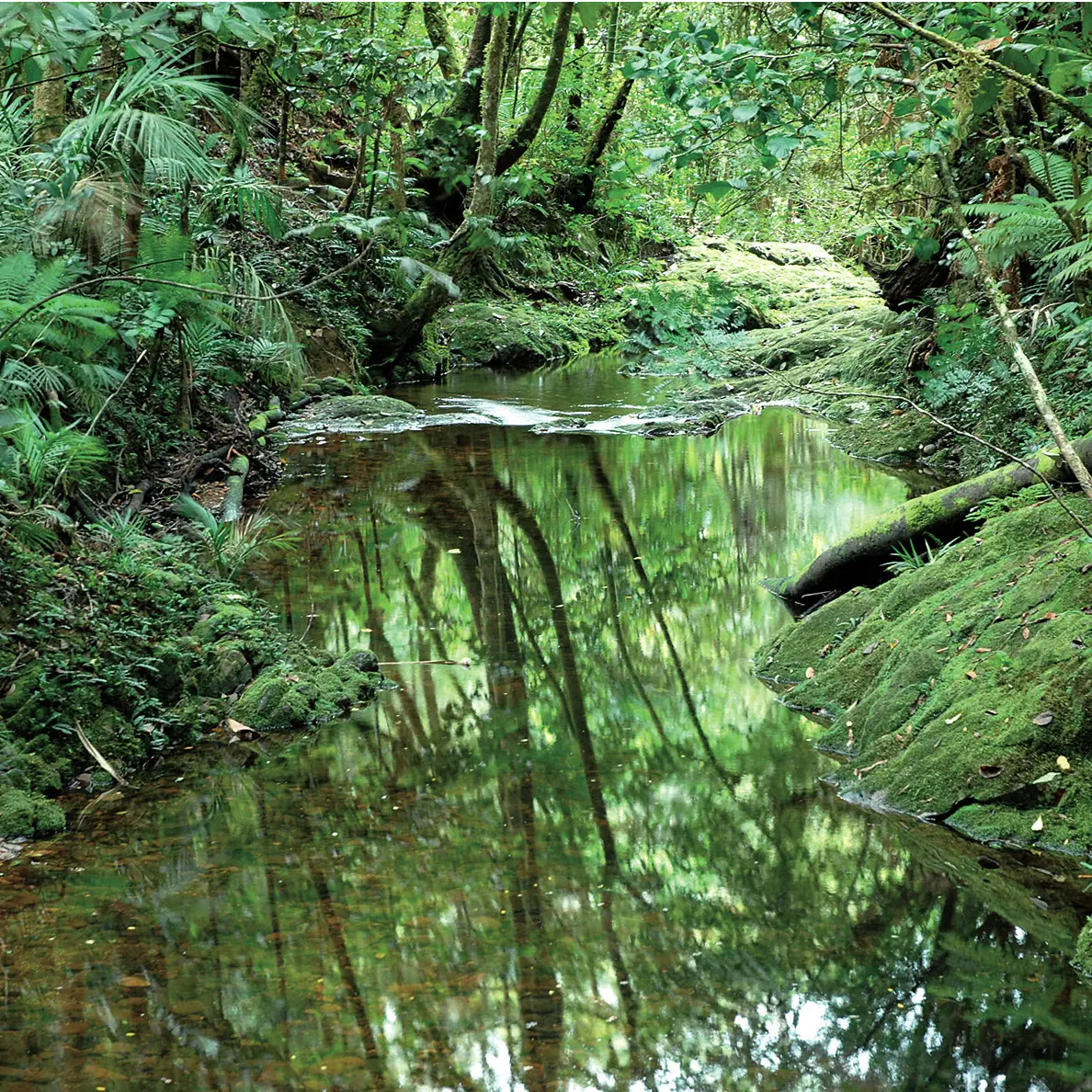
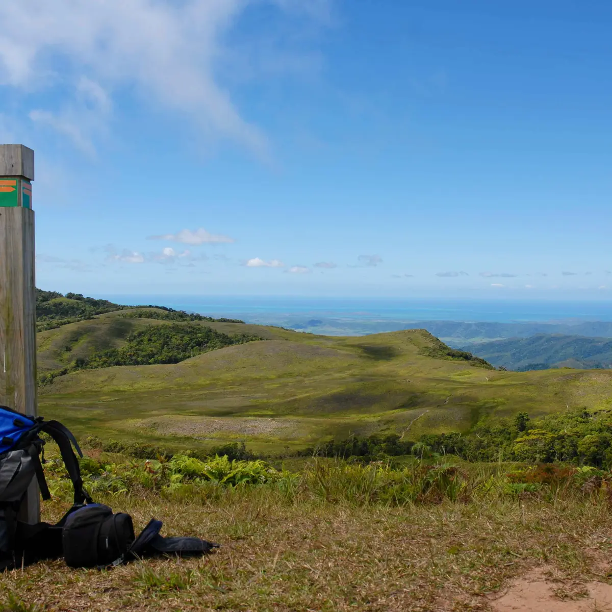
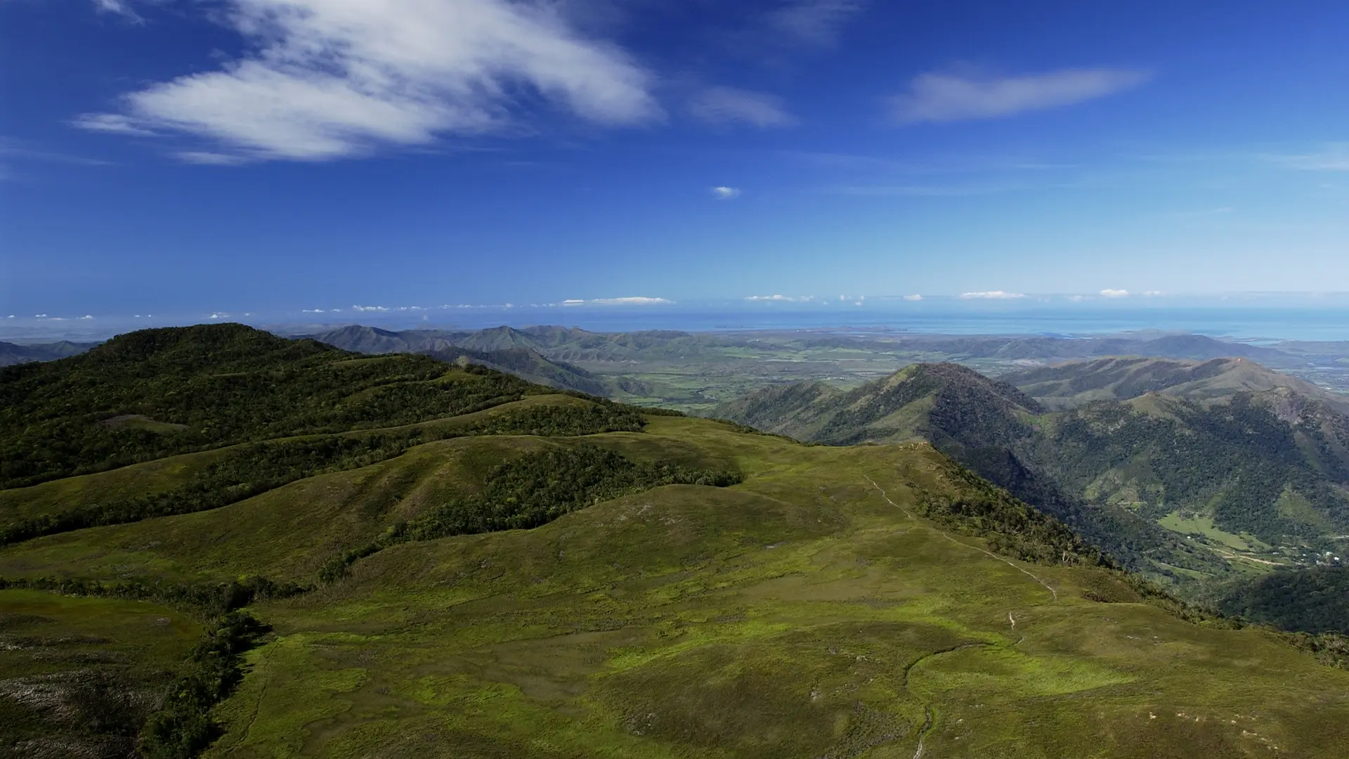
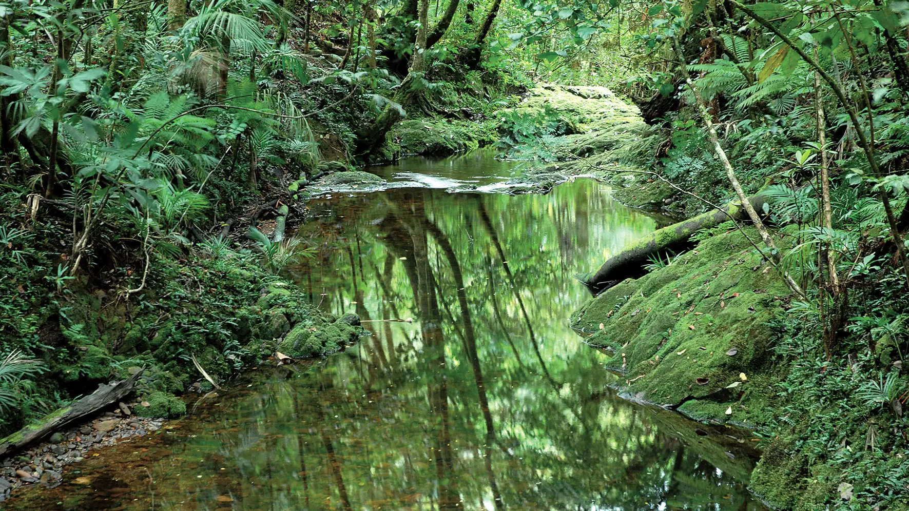
The Dogny Plateau is a long-standing meeting and trading point for the tribes from the east and west coasts. A number of trails criss-cross the remarkably preserved old-growth forest.
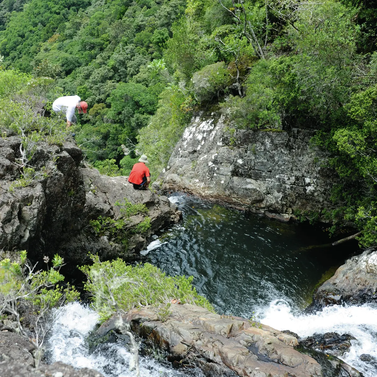
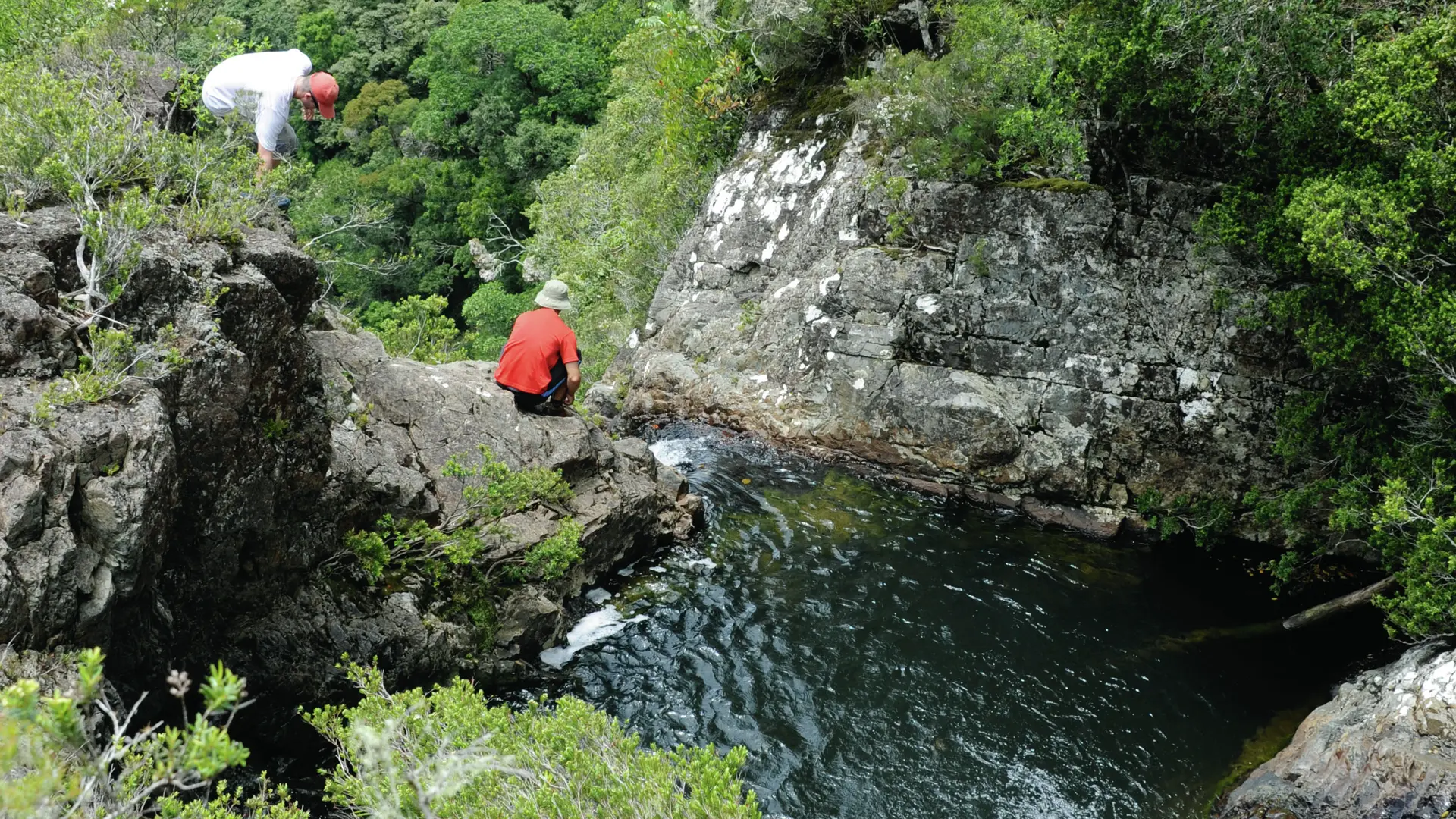
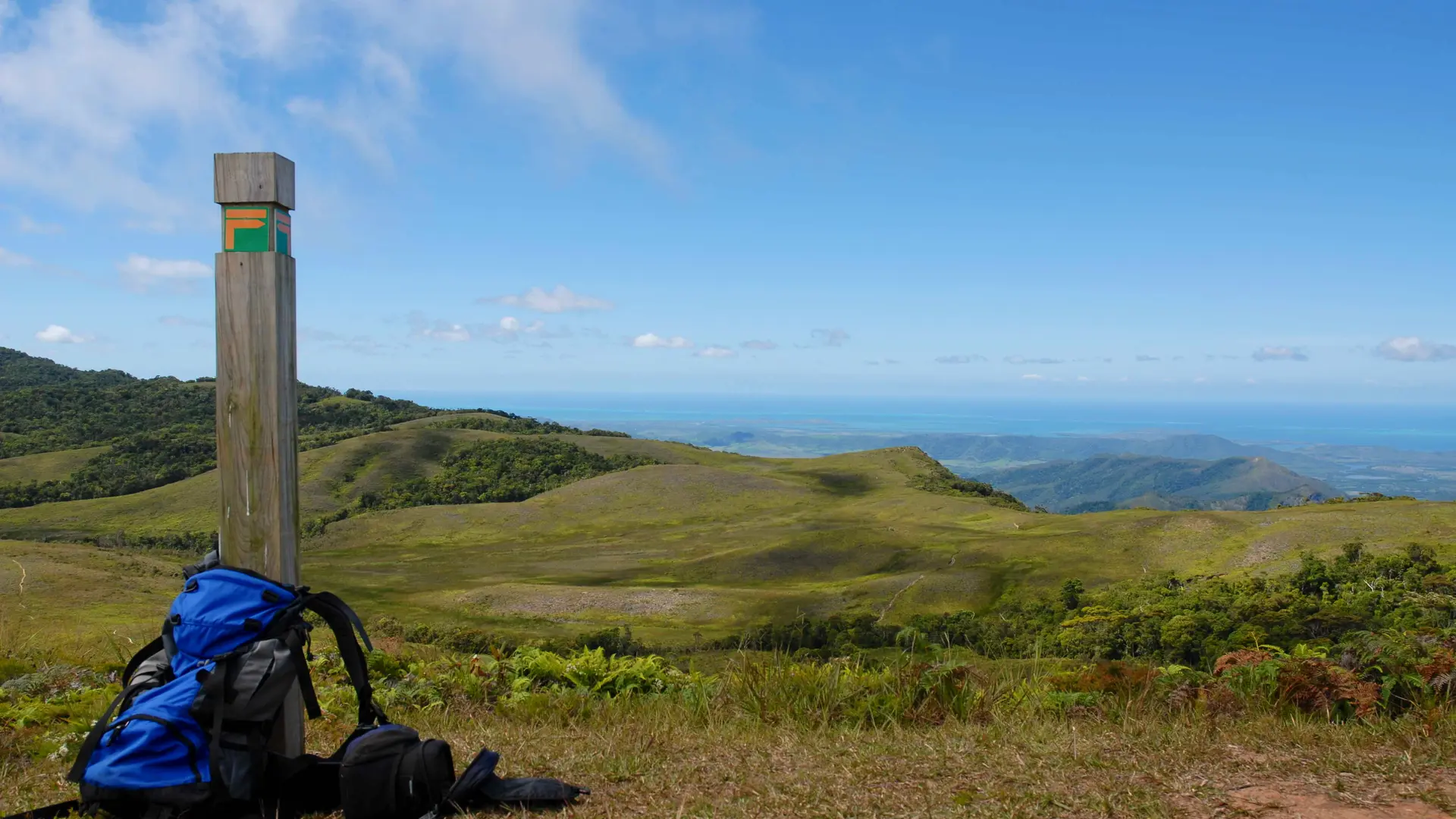
ROUTE DESCRIPTION D Car park: head towards the hotel (west). After about 150 m, turn right and pass the entrance gate to the hotel. Turn left at the first intersection (there are tennis courts to the right). Turn right and stay level. At the intersection, go down towards the river in front of you and then turn left. Cross an old fence and climb as far as the information board. 1 Information board (GPS: 589 403 – 7 607 066; alt. 159 m): continue along the grassy track that slopes gently upwards through rural countryside (a coffee plantation) on the right bank of the Xwê Wya. Reach another intersection. 2 Intersection: go straight ahead and continue to the next fork. Leave the main track and turn right towards the trail that enters a small forest. Cross a creek and climb up the deforested hill. Stay level before descending into the forest towards the Xwê Wya. Cross it (GPS: 589 566 – 7 607 971) and start climbing again. Go back down to another creek and cross it. Climb a few more muddy twists and turns until you reach a hilltop clearing (GPS: 589 771 – 7 607 988). Turn left to follow the rounded ridge that climbs to the Mërë Uki (cleared undergrowth, frequent game). The trail winds up the slope until it reaches a gap in the vegetation. 3 Xwê Wya Valley viewpoint (GPS: 589 901 – 7 608 753): continue climbing in a northerly direction. At an altitude of about 700 m, the trail curves to the north-east and then emerges at the edge of the open plateau. 4 Arrive at the plateau (GPS: 590 570 – 7 608 914; alt. 956 m) (information board): continue north for about 50 m (start of the tricky area in misty weather). Turn right (east) following the main path along the edge of the plateau. At the intersection, turn left and then descend (north/north-east) towards the open combe. Cross a creek and then turn right at the next intersection (the path that climbs to the north-west is a shortcut). Go down into the burnt forest. 5 Convergence of creeks (GPS: 591 587 – 7 609 271) (table): follow the creek downstream, sometimes passing the right bank, sometimes the left (in rainy weather). Arrive at another convergence of creeks. 6 Waterfall (GPS: 591 981 – 7 609 199; alt. 903 m): cross carefully using the safety rope (in rainy weather). Climb straight ahead to come out of the thalweg and walk along the wooded ridge towards the Némëré (follow the markers because orientation is tricky). Arrive at a bamboo grove “drowned” in the forest. 7 Bamboo: continue to climb in stages until you reach a fork south of the flat-topped summit of the Némëré. 8 Flat-topped summit (GPS: 592 627 – 7 609 912; alt. 1,058 m): turn left (the trail to the right (north-east) leads to the Bwara and Ema tribes near Canala) towards the long wooded ridge that surrounds the plateau (note: follow the markers). Gradually descend until you reach a pass and a spring. 9 Water point (GPS: 592 206 – 7 610 119; alt. 1,024 m): climb up to the wide, rounded ridge to the west (northern edge of the plateau). Emerge on a flat summit topped with a clearing. 10 Summit (GPS: 591 670 – 7 610 287; alt. 1,056 m) (unobstructed view of Canala): descend steeply south-west towards another pass and then go back up to a small, bare summit. 11 Viewpoint (GPS: 590 890 – 7 610 036; alt. 1,062 m) (viewpoint to Canala Bay): continue straight ahead to the edge of the ridge and then turn left at a small grassy knoll towards the creek visible below. 12 Creek: cross a culvert and then climb up to the western edge of the plateau. Cross a small, marshy combe below the Dö Nyi. Following the edge of plateau, you’ll come to a hillock that overlooks the west side and the foothills. 13 Viewpoint (GPS: 590 567 – 7 609 045): from here, return to the start of the descent at the edge of the plateau. 4 Start of the descent: follow the same route back down to the car park. © Text by Jean Francis Clair FFrandonnée® grading * Effort: IBP 115 difficult (dark blue) * Technical difficulty: quite difficult (orange) * Risk: quite high (red) * Overall grading: difficult (dark blue)
Read more
Plain text period
All year round daily.
Subject to favorable weather.
Services
Picnic area
Pets welcome
The route passes through an IBA (Important Bird Area) where there are a number of kagus. You are strongly advised not to bring your dog.
Documentation
WPT Dogny
Dépliant sentier du Dogny
Environment
Forest location
Mountain view
Panoramic view
Firm favourites / must-sees
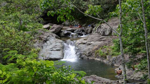
La Cuve de Sarraméa
Treat yourself to a refreshing swim after the 5-minute walk that leads to this superb water hole in the commune of Sarraméa!
Sarraméa
Close
Popular searches
{% label %}
Filter search
Filter search
Tourist Offers
Business Offers
Page types
All
Articles
Agenda
Lists
Aucun résultat
/
Anglais
Français
日本語
Trade & Médias
Close
×