Aller au contenu principal
Weather
Map
GB
Voir les favoris
en
New Caledonia Tourism: The official website for tourism in New Caledonia
Discover the archipelago
Aerial view of Nouméa, New Caledonia
©
Aerial view of Nouméa, New Caledonia
Nouméa
Top experiences in Nouméa
Amédée Lighthouse
Tjibaou Cultural Centre
Nouméa's bays
Aquarium des Lagons
All things to do and see in Nouméa
Kiki Beach, Lifou
©
Kiki Beach, Lifou
The Islands
Top island experiences
Isle of Pines
Ouvéa
Lifou
Maré
All things to do and see in The Islands
Cattle return to the Néméara farm, Bourail
©
Cattle return to the Néméara farm, Bourail
West coast
Top West Coast experiences
Bourail
La Foa - Farino
Koné - Voh - Pouembout
Poum - Koumac
All things to do and see on the West Coast
Linderalic rocks, Hienghène
©
Linderalic rocks, Hienghène
East Coast
Top East Coast experiences
Hienghène
Poindimié
Thio
Hienghene’s hen and rock formations
All things to do and see on the East Coast
Bivouac at the Blue River Park, Yaté
©
Bivouac at the Blue River Park, Yaté
Great South
Top Great South Experiences
Yaté
Mont-Dore
Blue River Provincial Park
Casy islet
All things to do and see in the Great South
Must-see places
Geography & biodiversity
History of the archipelago
11 reasons to come
Activities
Snorkeling with a lagoon turtle
©
Snorkeling with a lagoon turtle
Heavenly lagoon
Beaches and islets
Diving
Snorkelling
Whale watching
Sailing and navigation
Preserved natural spaces
Birdwatching at the Parc des Grandes Fougères
©
Birdwatching at the Parc des Grandes Fougères
Preserved nature
Hiking, walking, trail running
Boardsports
Horse Riding
Mountain biking and cycling
Scenic flights
Kayaking
Traditional Kanak dancers
©
Traditional Kanak dancers
Authentic cultures
Kanak culture
Bush culture
Local Art
Museums
Heritage
Not-to-be-missed events
Lobster on the beach facing the lagoon, New Caledonia
©
Lobster on the beach facing the lagoon, New Caledonia
Local gastronomy
Local produce
Local cuisine
6 dishes to try in New Caledonia
Where to eat Bougna?
Relaxing in front of the lagoon on the Isle of Pines
©
Relaxing in front of the lagoon on the Isle of Pines
Leisure and relaxation
Nightlife
Spa and wellness
Golf
Romance
Top relaxing experiences
Cruise
Family
Inspiration
Top 50 experiences
Plan your trip
Accommodation
Hotels
Gîtes
Tribal Stays
Youth hostels
Campsites
Eco-responsible
Serviced apartments
All accommodations
Bar of the Sheraton Deva hotel in Bourail
©
Bar of the Sheraton Deva hotel in Bourail
Bars and restaurants
Road trip to Hienghène, seaside road
©
Road trip to Hienghène, seaside road
Transport
Fête Nationale in Nouméa
©
Fête Nationale in Nouméa
Calendar of Events
Beach of the hotel Paradis d'Ouvéa
©
Beach of the hotel Paradis d'Ouvéa
Special offers
Travel guide
Plan your trip from A to Z
Travel specialist
Passport, visa and customs
Flights to New Caledonia
Airport information
Mobile Internet
Arriving by boat
Money and currency
Health & Safety
Weather and seasons
Traditions
Brochures
F.A.Q
Getting around
Itineraries / Road trip
Homepage
Chemin des Bagnards
Chemin des Bagnards
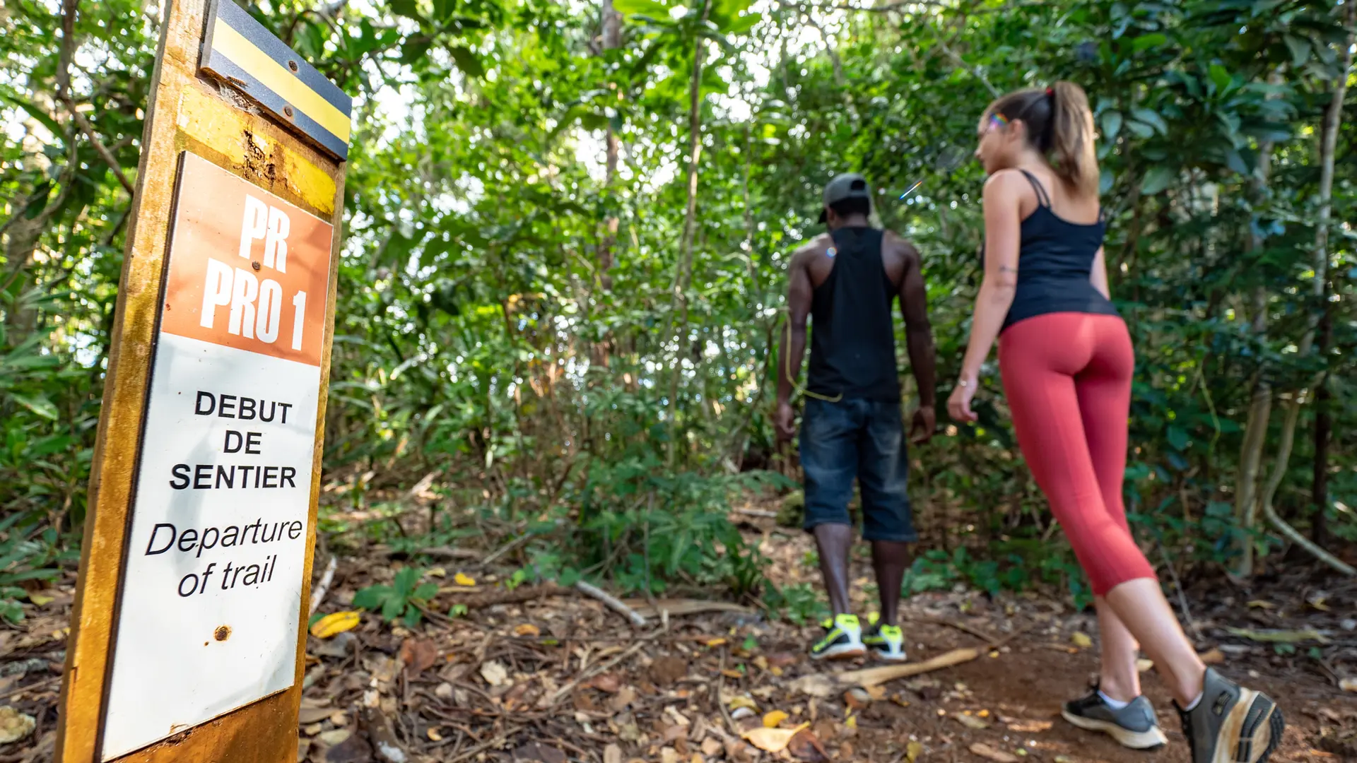
Sport
Pedestrian sports
Hiking itinerary
Elevation : 14m
Port Boisé, 98809 Mont-Dore
Getting there
×
Open the itinerary in
Google Maps
Apple Plans
Waze
Mappy
Share
Ajouter aux favoris
Add to my favorites
×
Share this sheet
Chemin des Bagnards
E-mail
WhatsApp
Facebook
X
LinkedIn
Pinterest
©
Oneye Production
©
@J.F. Clair
©
@J.F. Clair
©
ATGS
©
Oneye Production
×
©
Oneye Production
©
@J.F. Clair
©
@J.F. Clair
©
ATGS
©
Oneye Production
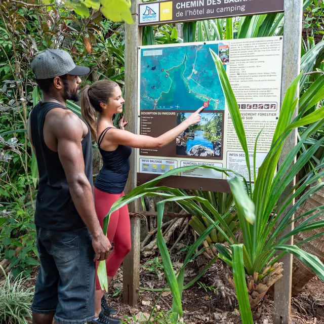
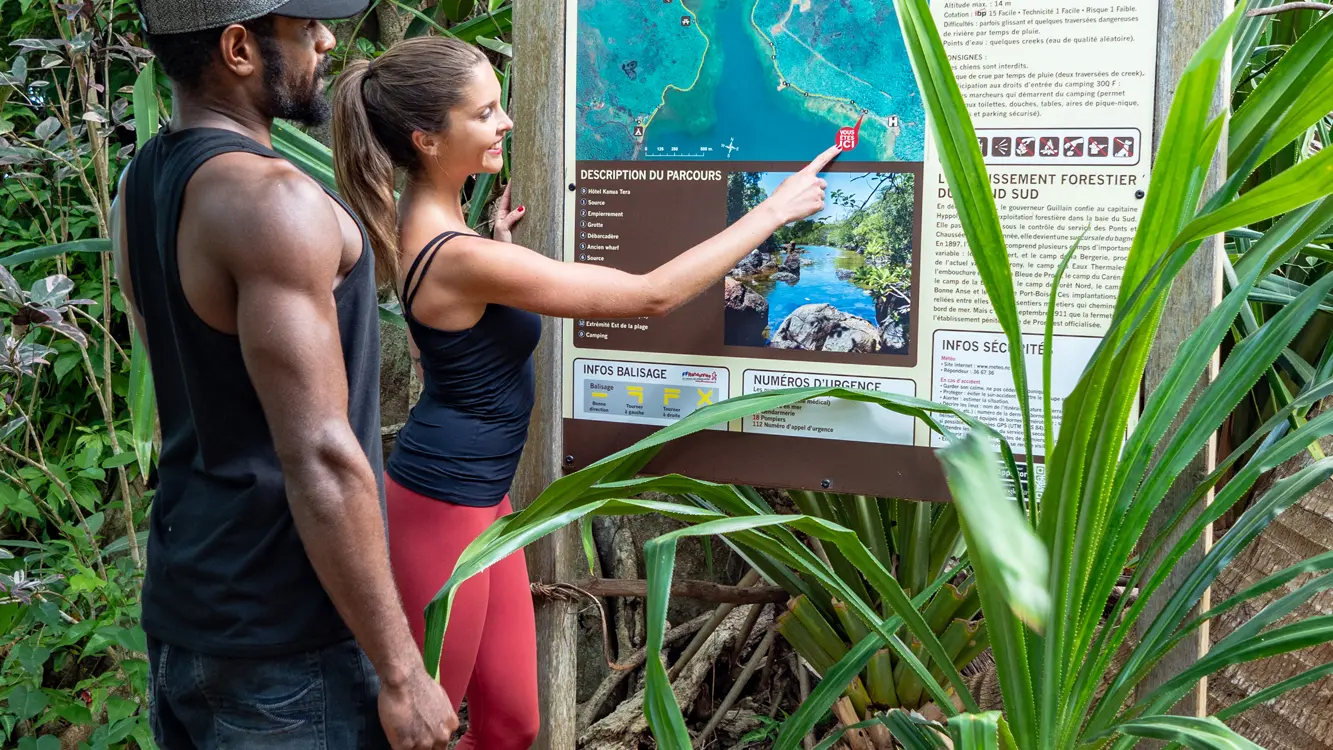
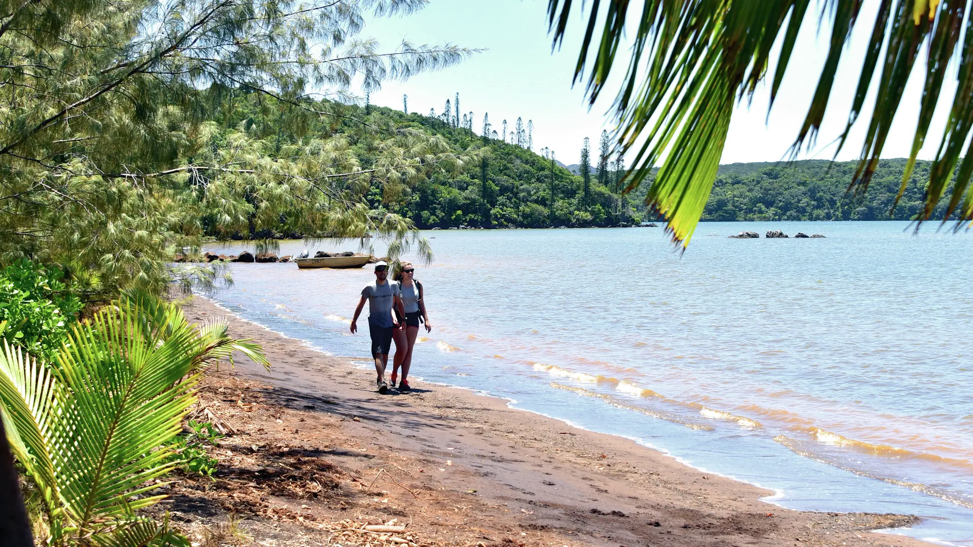
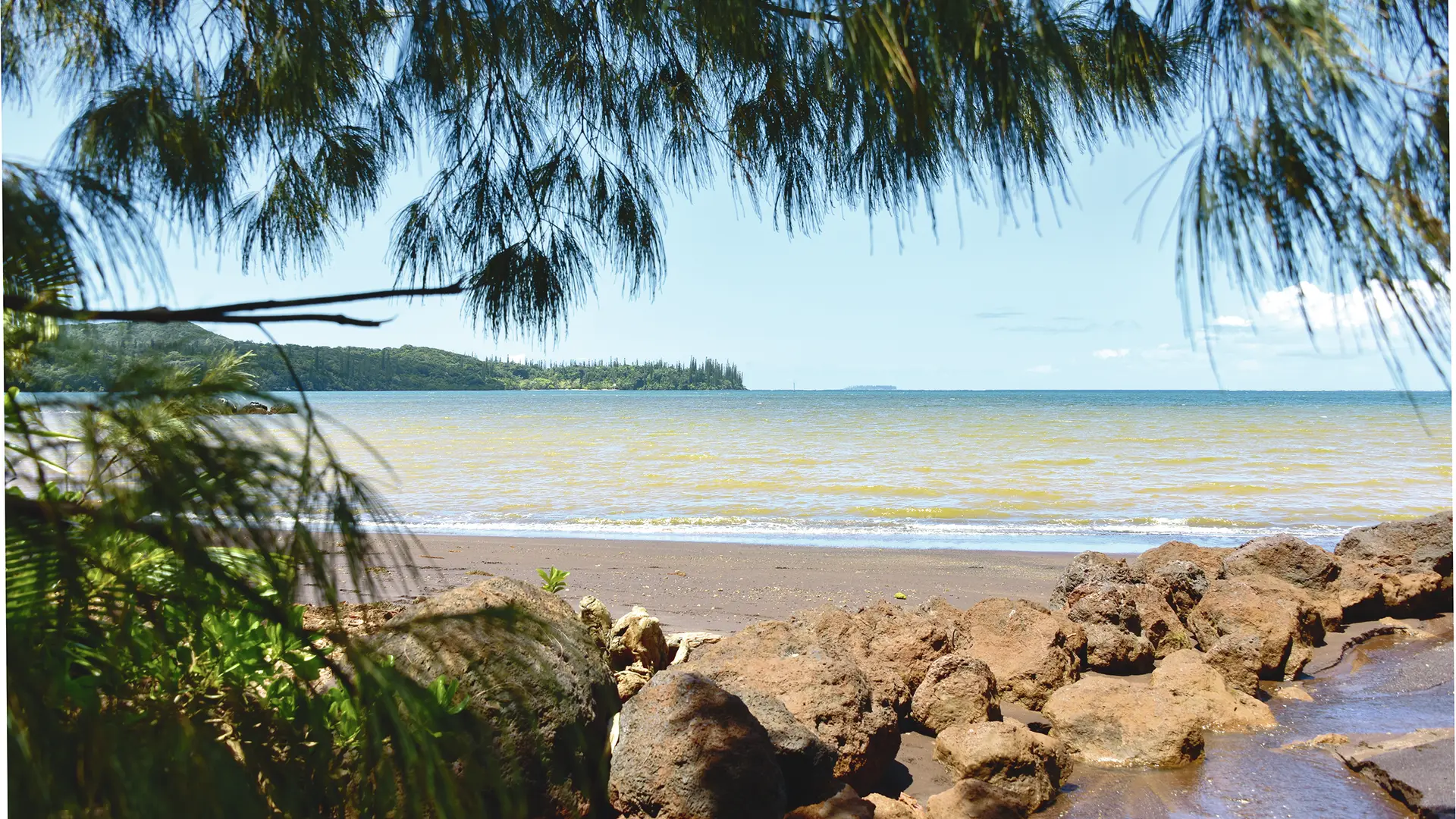
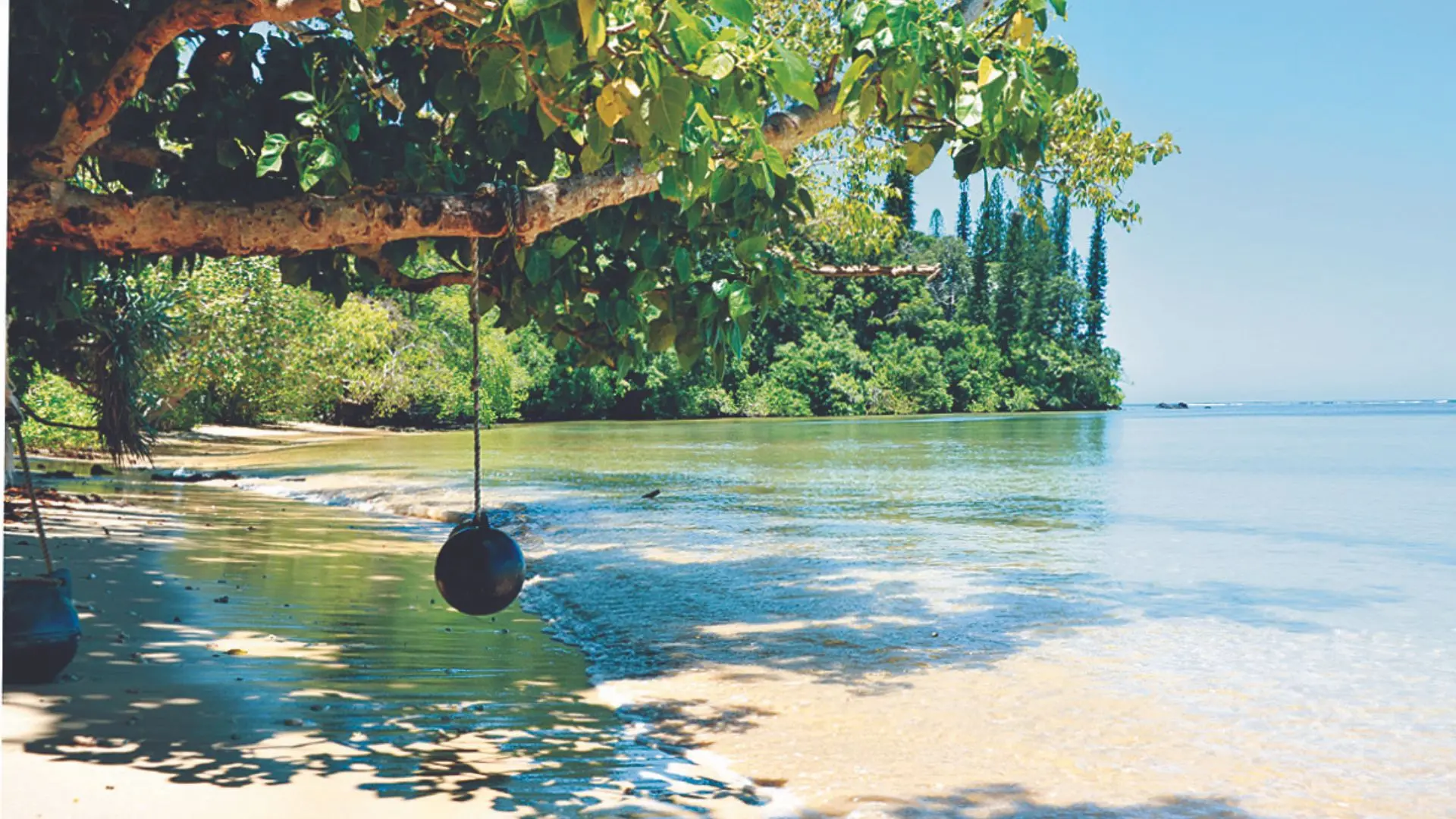
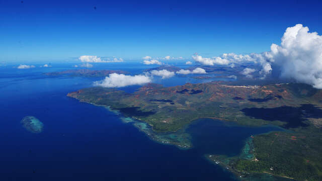
This nice family trail links Kanua Tera Ecolodge to Port-Boisé Camping (and vice versa), at the end of the bay. It uses one of the old paths of the Penitentiary. You are evolving close to customary lands, so be sure to respect the place.
It comes close to customary land, so please be respectful. D Hôtel Kanua Tera (GPS: 702 890 – 7 527 155): from the hotel entrance (car park, bar, restaurant, toilets), head west on the main track that runs between the bungalows and the mountains. After 200 m you’ll come to the sign for the departure point. Enter the forest using the trail by the sea, following the water pipe (an easy, peaceful track). Arrive at a stony pool (it was used by the convicts travelling along this path). 1 Spring (GPS: 702 813 – 7 527 222): (unpredictable water point) continue along the water's edge. Pass a daymark (white sheet metal triangle used as a navigation marker). Continue along the coast. You’ll reach some ruins (low walls that stabilise the path). 2 Stonework (GPS: 702 447 – 7 527 287): follow the coastline. Just before the wharf, you’ll see a cave on the right of the trail (one of many possible rock shelters scattered along the coast and quite a good example of a what prehistoric dwellings in the area might have looked like). 3 Cave (GPS: 702 299 – 7 527 359): pass the crevice and go down towards the shore. 4 Jetty (GPS: 702 269 – 7 527 373): (it is now used by maritime pilots to reach the pilot boat that takes them out to meet ships heading in from the sea). Climb 200 m to the north-west along the access road. Turn left at the marker and take the trail that runs along the coast. 5 Former wharf (GPS: 702 176 – 7 527 573) : (where logs used to be loaded for transportation to Nouméa). Continue your walk by the sea. 6 Spring (GPS: 702 157 – 7 527 671): stay close to the coast until you reach an intersection. Ignore the track that climbs to the right (east) and walk to the former bridge. 7 Former bridge (GPS: 702 085 – 7 528 325): (only the columns are still visible). The trail then meets the river following an old (sometimes slippery) track. 8 Rivière du Trou Bleu (Blue Hole River) (GPS: 702 071 - 7 528 523): (its balance is fragile: no fires, no rubbish and no pollution of any kind). Cross it and continue south along a red dirt track. 9 Former bridge (GPS: 702 025 – 7 528 359): then turn left towards the water's edge (view of the columns of the former bridge seen in point 7). Turn right to take the trail that runs along the shore. You’ll reach a small, shady creek. 10 Former bridge (GPS: 701 390 – 7 528 057): just after crossing the creek, a short climb will bring you to a viewpoint of the bay. Continue along the shore towards a former camp by the sea (a few artefacts remain from its forestry operation days, including a bread oven from the Port-Boisé bakery). 11 Bread oven (GPS: 701 511 – 7 527 869): continue along the coast towards the south. 12 Eastern tip of the beach (GPS: 701 211 – 7 527 206): pass a marker created by two white sheet metal triangles (daymark). The trail then emerges onto the red sand beach. Cross the small riprap that borders the creek. In the middle of the beach is the entrance to the campsite. D Campsite (GPS: 701 059 – 7 527 089): (information board). © Text by Jean Francis Clair FFrandonnée® grading * Effort: IBP 15 easy (green) * Technical difficulty: easy (green) * Risk: low (green) * Overall grading: easy (green)
Read more
Plain text period
All year round.
Services
Picnic area
Car park
Documentation
Fiche descriptive Bagnards
Environment
Sea view
Coastal
Is located at the end of...
Is located at the start of...
Useful address
On the premises
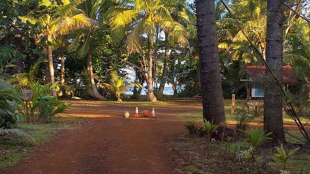
Port Boisé Camping
Pitch your tent in a typical Great South setting at the edge of a black sand beach in magnificent Port-Boisé Bay!
Yaté
Restaurant Le "Kâ-Mâ" du Kanua Tera Ecolodge
Feet in the water of the Bay of Port Boisé, in the shade of a century-old Grand Banyan, the "Ka-Mâ" is the promise of reunion with all the specialities and fresh quality...
Mont-Dore
Bookable
Port-Boisé Bay
With its silvery black sand, ochre sand typical of the area and incredible white sand, it's little wonder Port-Boisé Bay has a secret entrance to keep its treasures well hidden...
Yaté
Close
Popular searches
{% label %}
Filter search
Filter search
Tourist Offers
Business Offers
Page types
All
Articles
Agenda
Lists
Aucun résultat
/
Anglais
Français
日本語
Trade & Médias
Close
×