Aller au contenu principal
en
New Caledonia Tourism B2B Website
TOURISM OBSERVATORY
en
GB
New Caledonia Tourism: The official website for tourism in New Caledonia
New Caledonia Tourism
New Caledonia Tourism
©
New Caledonia Tourism
Our Organisation & Missions
NCT HQ Team in Nouméa
©
NCT HQ Team in Nouméa
Teams and Members
New Caledonia Tourism HQ
©
New Caledonia Tourism HQ
Collaborate with Us
Contact Us
Our Campaigns
See All
The destination & its offerings
Upi Bay, Isle of Pines
©
Upi Bay, Isle of Pines
10 Reasons to Go
Le Méridien Île des Pins
©
Le Méridien Île des Pins
Tourism Directory
Flight over the Heart of Voh
©
Flight over the Heart of Voh
Image & Positioning
Priority Markets
Thematic Fact Sheets
See All
Ressources & tools
Workshop Rendez-Vous in New Caledonia 2023
©
Workshop Rendez-Vous in New Caledonia 2023
Trade
The Today Show in New Caledonia
©
The Today Show in New Caledonia
Media
Mice Elissalde Arnaud2
©
Mice Elissalde Arnaud2
MICE
Cruise ship at the Quai Ferry in Nouméa
©
Cruise ship at the Quai Ferry in Nouméa
Cruise
Le Méridien Île des Pins
©
Le Méridien Île des Pins
Tourism Directory
Investing in New Caledonia
©
Investing in New Caledonia
Investors
Photo Library
Brochures
See All
News
Marathon International Mobil in New Caledonia
©
Marathon International Mobil in New Caledonia
All Our News
Workshop Rendez Vous In New Caledonia 2023 Auriane Demeusy4
©
Workshop Rendez Vous In New Caledonia 2023 Auriane Demeusy4
Activity Reports
Turtle watching in New Caledonia
©
Turtle watching in New Caledonia
Newsletters
Press Releases
Promotional Activities
Media Coverage
Homepage
Casy islet Path
Casy islet Path
Sport
Pedestrian sports
Hiking itinerary
Elevation : 39m
Îlot Casy, 98809 Mont-Dore
Getting there
×
Open the itinerary in
Google Maps
Apple Plans
Waze
Mappy
Share
Ajouter aux favoris
Add to my favorites
×
Share this sheet
Casy islet Path
E-mail
WhatsApp
Facebook
X
LinkedIn
Pinterest
©
@J.F. Clair
©
Oneye Production
©
Oneye Production
©
Oneye Production
©
@J.F. Clair
×
©
@J.F. Clair
©
Oneye Production
©
Oneye Production
©
Oneye Production
©
@J.F. Clair
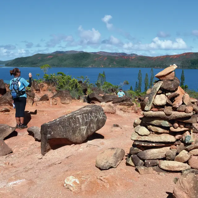
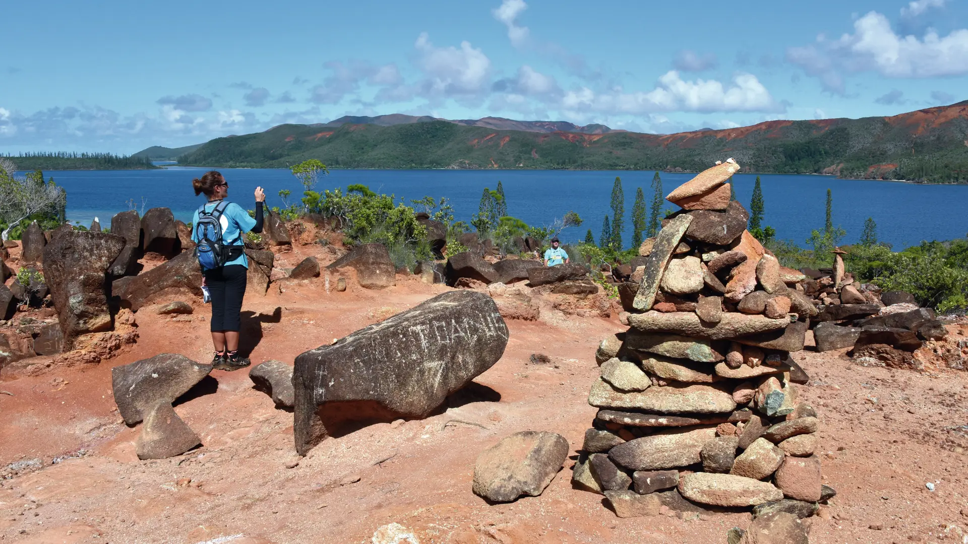
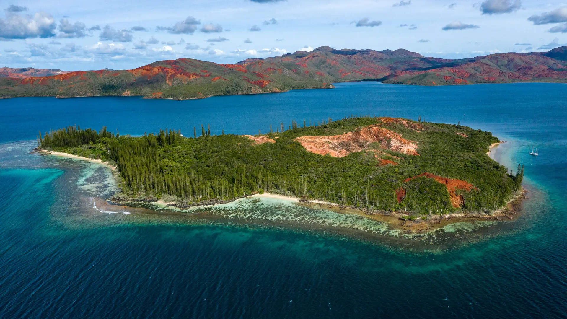
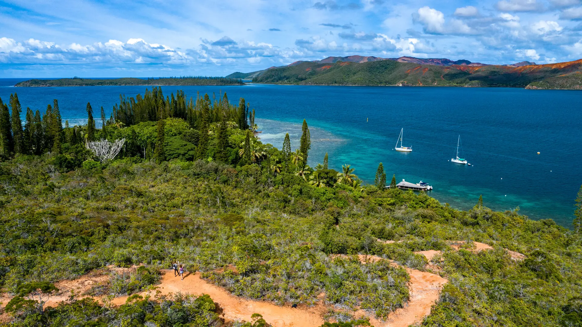
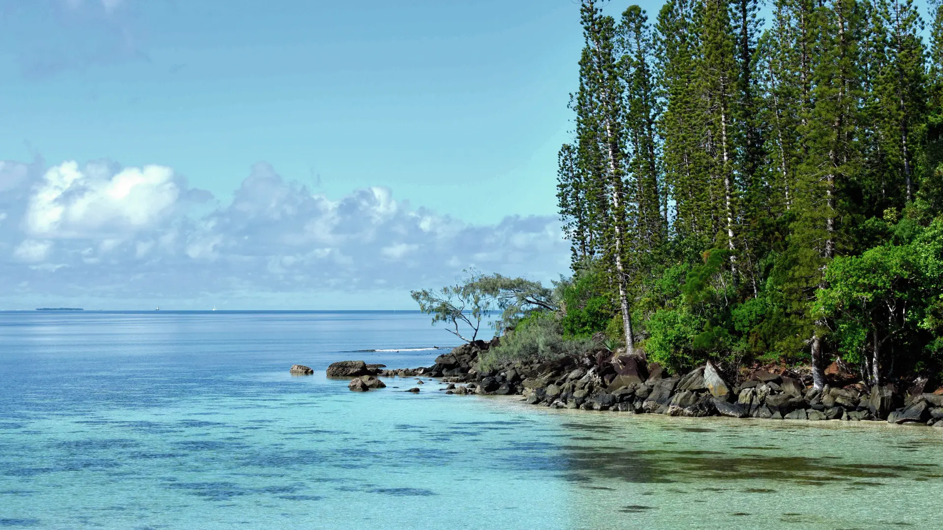
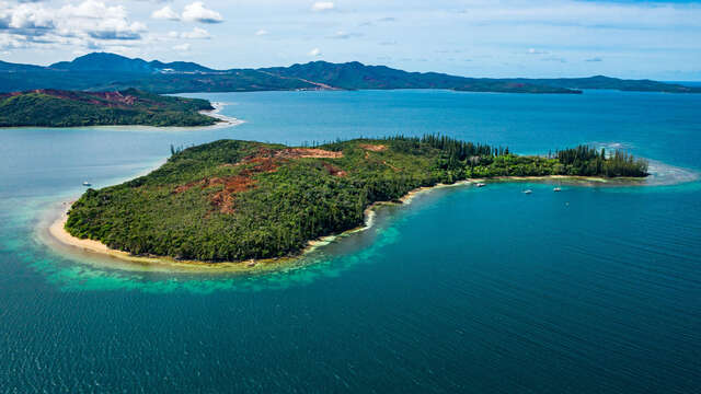
Tour of the Casy islet. Itinerary full of history (remains of the prison: cultivation area, a cemetery with some graves). It goes through beautiful forests of araucarias and cycas. Some pleasant and shaded coves mark the route.
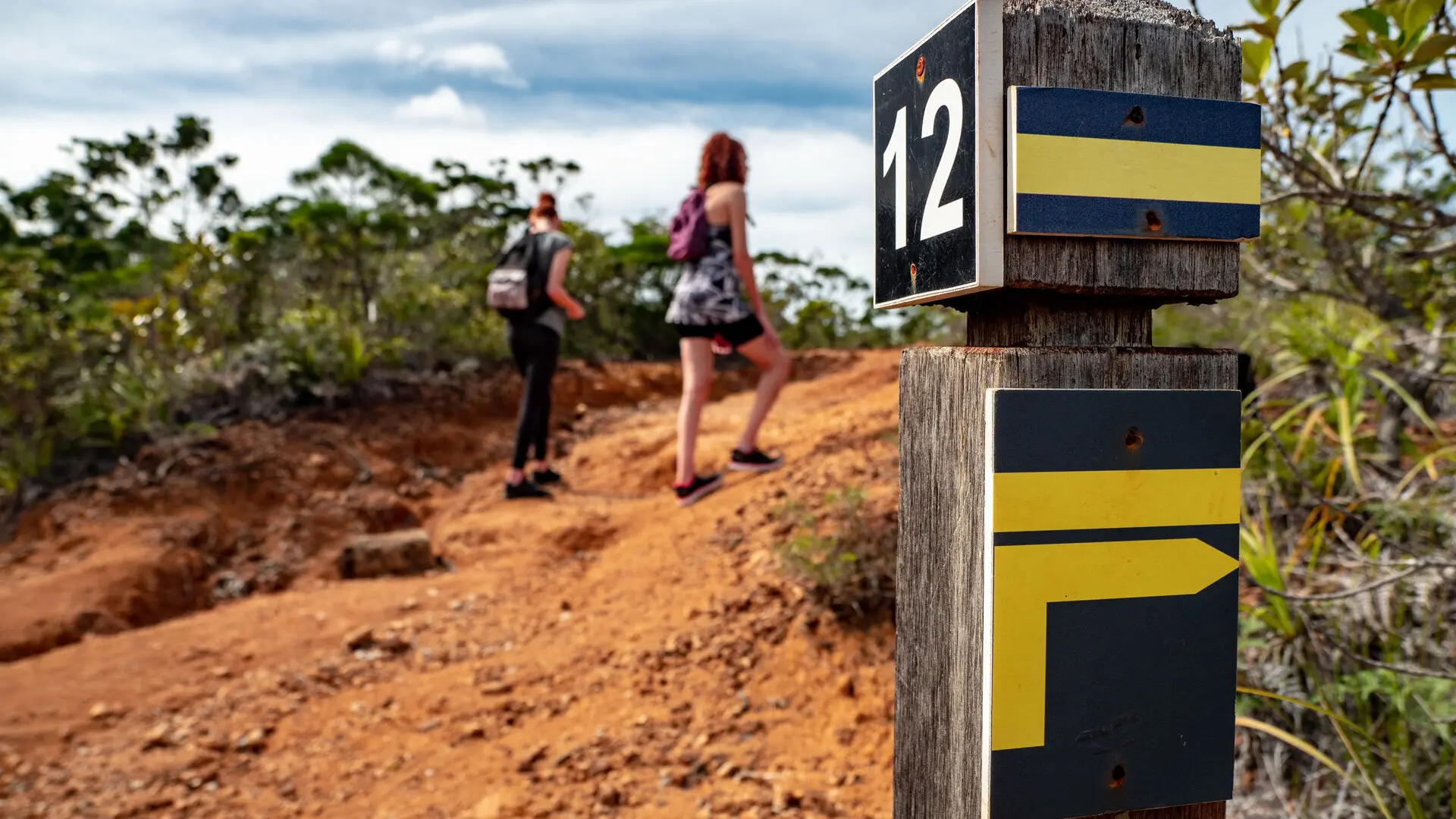
D Departure (GPS: 689 815 – 7 526 562; alt. 1m): from the wharf, head south-east along the seaside, among the tall trees. 1 Shortcut (it starts on the left and enables you to reach the east coast directly at No. 4): continue to the end of the clearing. Take the marked and maintained path. 2 Access to the old well: from this point, continue on the main track and climb towards the south-east up a small steep path to reach the cemetery at the top of the hill. 3 Tombs (GPS: 689 899 – 7 526 295; alt. 15m): turn left towards the east and descend in zigzags towards the seaside. At the beach, head north (view of the Goro Nickel factory) progressing along the seaside to the next intersection. 4 Shortcut (it goes to the left, towards the west, and directly joins point No. 1): walk straight ahead among the columnar pines and cycads along the beach. At its northern end, bypass the rocky outcrop to the left. 5 Black Stones (GPS: 690 047 – 7 526 538; alt. 7m) after a short climb, walk above the shore to pass a small cape and reach a beautiful beach framed by black rocks and columnar pines. 6 Viewpoint (GPS: 690 120 – 7 526 854; alt. 10m) (view of the entire eastern part of the north Bay and the Goro Nickel factory): leave the shore and climb due west through a small forest, towards the plateau. You reach a bowl of red earth. 7 Crossing (GPS: 690 120 – 7 526 854; alt. 10m): take a sharp right towards the north-west, then the north (the path which goes to the left, towards the west, leads directly to the starting point). Go along the eastern edge of the plateau and down towards the seaside through a small forest. Cross a wooden culvert. 8 Camp site (GPS: 689 896 – 7 527 067; alt. 10m): at this point, turn left to leave the seaside and go up towards the plateau in a short, shaded climb. At the level of the ravine area, take a clear right (west) to reach an intersection. 9 Access to the seaside (the well-marked track, on the right, descends towards a shaded beach; a pleasant picnic area): return to the route and continue towards the south-west, then the east. Reach the bare plateau and a fork (on the left, a path leads to a pretty viewpoint with many cairns). 10 Access cairns: return to the junction. Turn left to the next point. 11 Plateau crossroads (GPS: 689 854 – 7 526 769; alt. 35m) (on the left is the destination of the shortcut towards the east): continue on the main path towards the south, until the next intersection. 12 Access to the summit (on the left, a short climb leads to the highest point of the island, alt. 45m): return to the wharf by a few zigzags. © Text by Jean Francis Clair FFrandonnée® grading * Effort: IBP 15 easy (green) * Technical difficulty: Fairly low (light blue) * Risk: Fairly low (light blue) * Overall score: Fairly easy (light blue)
Read more
Documentation
WPT Casy
Fiche descriptive
Environment
Forest location
Sea view
Panoramic view
On the premises
Casy island
This previously inhabited island off the tip of the Great South now boasts an exceptional biodiversity!
Mont-Dore
Close
Popular searches
{% label %}
Filter search
Filter search
Tourist Offers
Business Offers
Page types
All
Articles
Agenda
Lists
Aucun résultat
/
Anglais
Français
日本語
General public website
Close
×